
A Burned Hillside Plus One October Storm: Why Southern California Faces a Different Kind of Flash Flood
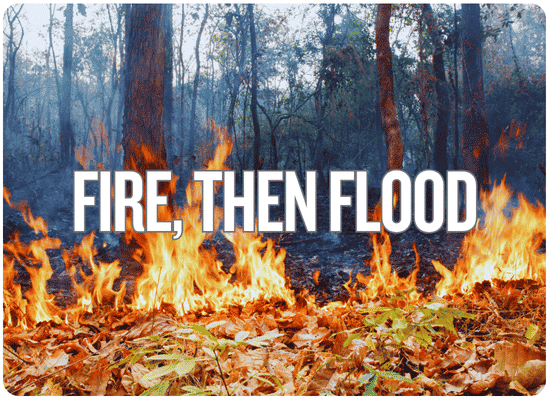
Southern California’s first serious rain of the season is arriving only days after new wildfires stripped vegetation from steep hillsides. The danger isn’t simply water in the street. On a fresh burn scar, a short burst of heavy rain can turn ash, soil, branches and boulders into a fast-moving debris flow.
Anyone who has spent much time around hillside drainage learns that a burned watershed is not the same watershed it was before the fire. The creek may have the same name and the canyon may look familiar, but the ground can respond completely differently when the first hard rain arrives.
Vegetation that slowed water is gone. Roots that helped hold soil together have been damaged. In some burned areas, the soil sheds water rather than absorbing it. Then a thunderstorm hits a steep slope and the runoff begins collecting ash, loose dirt, branches, rocks and whatever else is in the drainage path.
That is why this week’s Southern California storm deserves more attention than its rainfall totals alone might suggest.
What Is Happening Today
A deep storm system approaching Point Conception is pulling tropical moisture into Southern California and the broader Southwest.
The Weather Prediction Center has a Slight Risk of excessive rainfall across portions of Southern California. The National Weather Service in Los Angeles/Oxnard has issued Flood Watches for portions of Santa Barbara County as well as the Malibu Coast and the eastern and western Santa Monica Mountains.
The storm total is only half the story.
WPC says thunderstorms that repeatedly move over the same terrain could produce localized rainfall approaching two inches in an hour. That does not mean every neighborhood receives that rate. But on a recent burn scar, even a much smaller short-duration burst can matter.
The Los Angeles/Oxnard office expects the most active period from Wednesday into Thursday morning, with thunderstorms capable of producing locally heavy downpours.
The Ground Changed Before the Weather Did
Vegetation and ground cover are removed.
Some burned soils absorb less rainfall.
Water begins running downhill rapidly.
Soil, ash, rocks and vegetation enter the flow.
The mixture accelerates through channels and downhill terrain.
USGS says the most common post-fire debris flows begin when intense rainfall produces rapid surface runoff and erosion. Wildfire often reduces the soil’s ability to absorb rain, while the loss of vegetation leaves far more loose material available to move downhill.
Unlike some landslides that develop after days of saturated ground, a post-fire debris flow can begin on a relatively dry hillside after only minutes of intense rainfall.
Why “Only Half an Inch” Can Be Misleading
Southern California debris flows have occurred with surprisingly little rain.
USGS research has documented post-fire debris flows after roughly 0.3 inch of rain fell in 30 minutes. Rainfall rates above roughly 0.4 inch per hour have also historically been associated with debris-flow potential.
Those numbers are not universal trigger points. Every burn scar is different. Fire severity, slope, soil, drainage shape, watershed size and where the heaviest rain actually falls all matter.
That is why emergency agencies develop burn-scar-specific rainfall thresholds rather than relying on one statewide number.
Two inches spread gently across twelve hours is a very different hillside problem from three-quarters of an inch dropped during one violent thunderstorm.
Ordinary Flash Flood vs. Burn-Scar Debris Flow
| Typical Urban Flash Flood | Post-Fire Debris Flow | |
|---|---|---|
| Main material | Mostly water, sometimes carrying small debris. | A dense mixture of water, ash, soil, rocks, branches, trees and sometimes large boulders. |
| Primary trigger | Rainfall overwhelms drains, streets or waterways. | Short-duration intense rainfall generates rapid runoff over burned terrain and entrains sediment. |
| Where it starts | Low streets, streams and poor-drainage areas. | Often high on burned slopes or in steep drainage channels. |
| Where damage occurs | Low-lying neighborhoods and roads. | Burn scar, canyon mouth, drainage path and potentially miles downstream. |
| Structural force | Water pressure and current. | Water plus the impact and weight of rock, sediment, trees and other debris. |
| Best response | Protect property early and avoid flooded roads. | Evacuate when ordered. Property barriers should never be treated as life protection against a major debris flow. |
The New Burn Scars Make This Storm Different
Bryson Fire
The Bryson Fire started October 15 in the Malibu area and burned roughly 146 acres. The new scar sits in the same general Santa Monica Mountains / Malibu region now covered by an NWS Flood Watch.
Norte Fire
The Norte Fire started October 16 and burned roughly 570 acres near San Clemente and San Juan Capistrano. Local officials have already warned that the scar can face increased runoff, mudslide and debris-flow risk during rainfall.
These hillsides have barely had time to begin recovering.
Post-fire debris-flow susceptibility is generally greatest during the first rainy seasons after a wildfire. Vegetation has not returned and erosion-control work may still be underway when the first significant storm arrives.
The House Doesn’t Have to Be Inside the Burn Scar
This is one of the easiest risks to misunderstand.
A debris flow can begin high inside a burned watershed, follow a canyon or drainage course and continue well beyond the edge of the fire.
Post-fire debris flows can travel for miles and affect locations that were not burned — and in some cases places where little or no rain fell.
A homeowner should therefore look uphill and upstream, not simply at whether the property itself burned.
Six Property Questions That Matter More After a Fire
Is there recently burned land uphill?
The house may be outside the mapped burn perimeter while still sitting below a drainage basin that burned severely.
Does a canyon, wash or creek point toward the property?
Natural channels can concentrate runoff and debris from a much larger area than the individual parcel.
Is the house near a canyon mouth?
Debris flows can leave a confined channel and spread when they reach flatter ground below steep terrain.
Are culverts or drains carrying runoff from burned slopes?
Debris can block a culvert and suddenly redirect water and sediment into places that normally remain dry.
Is there evidence of older debris flow?
Old boulder deposits, sediment fans, channels or previous mud damage can be clues to how the watershed has behaved before.
Could the normal evacuation road become the drainage route?
A safe house does little good if the only road crosses a wash, creek or canyon channel that becomes impassable first.
Warning Signs That Mean Conditions Are Changing
A suddenly active wash or drainage channel means runoff is already concentrating upstream.
Increasing sediment can indicate that erosion is accelerating farther uphill.
Debris flows can carry trees and rocks and have been described as sounding like a freight train.
Falling or rolling material can signal slope instability or increasing runoff above.
A blocked channel or culvert can redirect flow away from its normal path.
This is not the time to finish placing sandbags. Follow the direction immediately.
What a Homeowner Can Do — and What Needs an Expert
Reasonable homeowner preparation
- Sign up for county and local emergency alerts.
- Know at least two evacuation routes where possible.
- Move vehicles away from washes and low drainage routes.
- Clear leaves and loose debris from existing gutters and accessible drains when it is safe.
- Direct ordinary roof runoff through existing downspouts toward a stable outlet.
- Move valuables and important records away from ground-floor exposure.
- Keep pets, medications and evacuation supplies ready before heavy rain begins.
- Photograph the property before the storm for insurance documentation.
Get professional drainage / geotechnical advice
- Constructing or enlarging retaining walls.
- Building permanent diversion berms or deflection walls.
- Changing the grade around a hillside property.
- Altering culverts, channels or creek drainage.
- Stabilizing a burned or failing slope.
- Installing major rock, gabion or engineered erosion structures.
- Designing debris barriers or basins.
- Redirecting substantial runoff toward another drainage route or neighboring property.
National Weather Service guidance emphasizes that sandbags, K-rails, culverts and retaining walls may help redirect ordinary mud or water, but they should not be expected to stop a significant debris flow. A true debris flow can carry enough rock and sediment to overwhelm small property-level barriers.
Why DIY Water Diversion Can Backfire
There is a temptation after a wildfire to build the biggest berm possible between the hillside and the house.
The problem is that water and debris still have to go somewhere.
The barrier redirects flow
A berm that protects one garage may unintentionally aim runoff toward another building, road or neighboring property.
The barrier creates a new failure point
Water backing behind an undersized wall or clogged drainage structure can overtop suddenly and concentrate the flow.
The culvert becomes the plug
Burn debris can clog an opening that previously handled water without trouble.
The design solves water, not debris
A structure sized for clear runoff may perform very differently when the flow contains sediment, branches and boulders.
For properties directly below steep burned terrain, a civil engineer experienced in drainage or a qualified engineering geologist can evaluate the watershed, likely flow paths and appropriate long-term measures.
The Evacuation Rule Is Different From a Wildfire
WAITdebris flows move fast
Waiting to “see what happens” can remove the escape window.
With wildfire, residents can sometimes see smoke or flame approaching. Debris flows can begin high in a watershed, move rapidly through a channel and arrive with very little warning. Official guidance says residents in vulnerable burn-scar areas should leave when told rather than waiting to confirm visually that the flow is coming.
Have phones charged, emergency alerts audible and shoes, keys, medications and pets ready before going to bed when heavy rainfall is expected over a nearby burn scar.
How Long Does the Added Risk Last?
A hillside does not return to normal as soon as the flames are extinguished.
USGS and National Weather Service guidance says elevated runoff and flash-flood susceptibility can last for several years, with the first one or two rainy seasons generally presenting the greatest debris-flow concern.
Recovery depends on how severely the watershed burned, how quickly vegetation returns, slope steepness, soil conditions and how much material is removed during later storms.
The Bryson and Norte fires occurred only days before this storm. They have had essentially no rainy-season recovery time before receiving their first significant test.
Research used for this FloodMart report
National Weather Service Los Angeles/Oxnard — October 20–21 Flood Watches and Southern California storm briefing.
NOAA Weather Prediction Center — October 21 Excessive Rainfall Outlook and Southwest forecast discussion.
U.S. Geological Survey — Post-Fire Flooding and Debris Flow research, rainfall-intensity thresholds and debris-flow runout guidance.
CAL FIRE — October 2026 Bryson and Norte Fire incident information.
California Governor’s Office of Emergency Services — burn-scar, mudslide and debris-flow preparedness guidance.
USDA Natural Resources Conservation Service — post-fire hillside drainage and erosion guidance.
National Weather Service — Flood After Fire / burn-scar debris-flow safety guidance.
Post-Wildfire Property Vulnerability Check
This is a preparedness screen, not a debris-flow forecast. It helps flag property characteristics that deserve closer attention after a nearby wildfire and identifies situations where professional site review may be worthwhile.