
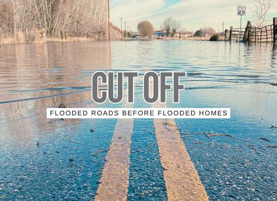
A flood can beat a homeowner without putting one inch of water inside the house. I have seen people obsess over door barriers and sump pumps while ignoring the road dip, the culvert, the railroad underpass, the low bridge, or the one neighborhood exit that decides whether they can get home, get out, or let help in. The September Northeast flooding made that point hard: roads filled, cars stalled, rail service broke down, an airport terminal closed, and emergency crews spent the morning rescuing people whose houses may not have been the first thing underwater.
The hidden flood loss
The September 2026 Northeast flash flood was a clean example of access flooding. In many places, the first crisis was not a living room filling with water. It was a road, ramp, underpass, train crossing, highway lane, airport terminal, or neighborhood route becoming unusable before people could safely move.
9 ways flash floods cut off a property first
01Underpasses fill faster than drivers expect
Railroad underpasses, highway underpasses, and depressed city streets can collect water quickly because they sit below the surrounding road network. A driver may see only a shiny surface, not the depth, current, stalled vehicles, open drains, or damaged pavement underneath.
02Culverts become bottlenecks
A culvert that works in normal rain can fail when water, leaves, sediment, branches, trash, or upstream debris arrive at once. If the culvert cannot pass the flow, water backs up on one side and may overtop the road.
03Low bridges become access gates
A low bridge can decide whether a neighborhood remains connected. Even if the bridge deck is not destroyed, water over the approach, debris at the opening, scour around the support, or barricades can cut the route.
04One-road neighborhoods lose options
A subdivision, rural road, hill neighborhood, island street, coastal lane, or private drive with one practical exit can become isolated even when every house stays dry. The weak point may be the entrance, not the home.
05Drainage crossings turn into temporary streams
Small dips, swales, ditches, driveway culverts, side-yard drains, and road-edge channels can become fast water paths. These are easy to miss on a sunny day because they look like ordinary neighborhood features.
06Street ponding blocks emergency vehicles
Fire trucks, ambulances, police vehicles, utility crews, and tow trucks still need safe road access. Several inches of moving water, hidden washouts, blocked lanes, or stalled cars can slow response even if the address itself is not flooded.
07Highways and ramps fail in pieces
A major interstate may remain partly open while ramps, low lanes, shoulders, or connector roads are flooded. That creates a false sense of access. The big road may be visible, but the last mile home can still be cut.
08Rail disruption changes family logistics
Floodwater and debris near tracks can cancel or delay commuter and intercity rail. That matters for families because a parent may be stuck away from the home, a child pickup may be delayed, or a normal commute may become a road detour through flooded streets.
09Airports and terminals can become local flood assets
A regional airport terminal closure is a reminder that access flooding can affect travel, family pickup plans, business continuity, emergency staging, medical trips, and visitors trying to leave before roads recover.
Access failure map
| Access weak point | Flood behavior | Property consequence | Family move |
|---|---|---|---|
| Underpass | Water collects below grade and depth is hard to judge. | Cars stall, rescues begin, direct route closes. | Mark every underpass on the route home and choose a higher detour. |
| Culvert | Flow backs up if the opening clogs or cannot pass peak runoff. | Road overtops, driveway access disappears, emergency crews reroute. | Watch culvert crossings after heavy rain and report debris before storms. |
| Low bridge | Water, debris, and scour affect bridge deck or approach. | Neighborhood may be cut off even with dry homes. | Know the second bridge or higher crossing before warnings begin. |
| One-road entrance | One dip, drain, gate, bridge, or low street controls access. | Residents cannot get in or out; responders may be delayed. | Build a household shelter-in-place and evacuation timing rule. |
| Drainage crossing | Small swales and ditches become active water channels. | Short road sections turn impassable quickly. | Do not treat shallow crossings as harmless during flash rain. |
| Emergency route | Flooded lanes, stalled cars, and barricades slow response. | Medical, fire, utility, and cleanup access can lag. | Share high-route instructions with family, caregivers, and contractors. |
A dry house is not fully safe if the only usable road, bridge, culvert, or underpass is already underwater.
Connecticut access lessons from the September flood
The event showed several different access failures at the same time: local streets, highways, rail lines, airport access, underpasses, road dips, and neighborhood roads.
| September signal | Reported impact | Broader lesson |
|---|---|---|
| Westport vehicle rescues | Multiple motorists were trapped by floodwater and some needed high-water vehicles. | Road flooding can become the first life-safety problem. |
| New Haven flooded streets | Multiple feet of water, stranded vehicles, and cars or buses stuck in floodwater were reported. | Urban access can fail before homes become the headline. |
| Norwalk train-track underpass | A vehicle was reported stuck in floodwater at an underpass near train tracks. | Below-grade road sections deserve special attention on family route maps. |
| Old Saybrook railroad overpass | A road near a railroad overpass was closed because of flooding. | Rail corridors and road underpasses can become local bottlenecks. |
| I-95 and Route 15 lane closures | Flooded lanes and highway closures disrupted regional movement. | The major road may not be the safe road during flash flooding. |
| Metro-North and Amtrak disruption | Rail service to New Haven saw delays, cancellations, and temporary suspension issues. | Flood access planning includes commuters, not only drivers. |
| Tweed New Haven Airport closure | The departure terminal was closed due to local flash flooding. | Travel assets can become local flood pinch points too. |
House access flood risk score
Use this simple tool to estimate whether a property can be cut off before water reaches the door. It is a planning aid, not an engineering report, flood forecast, evacuation order, or emergency routing tool.
Score logic: underpass exposure, drainage crossings, route redundancy, road-flood history, and emergency-access need are combined into a 100-point planning score. Isolation exposure multiplies affected people by possible access-blocked hours.
Family access plan before the next flash flood
| Planning item | Question to answer before rain | Practical move |
|---|---|---|
| High route home | Which route avoids underpasses, low bridges, road dips, and creek crossings? | Save it in every driver’s phone and print it for the house. |
| School and child pickup | Who gets the kids if the normal road or train line is blocked? | Name a backup adult and agree on a no-driving-through-water rule. |
| Medical access | Can an ambulance reach the property if the nearest crossing floods? | Share alternate access instructions with caregivers and emergency contacts. |
| Work commute | Can a parent get stranded away from the house by rail or highway disruption? | Delay travel when flash flood warnings cover commute corridors. |
| Contractor access | Can a plumber, electrician, cleanup crew, or tow truck reach the home? | Keep local contacts and send them the safer route, not just the address. |
| Shelter-in-place | Can the household function for 12 to 24 hours if roads are closed? | Keep water, food, medication, power banks, lights, and pet supplies ready. |
Neighborhood and local-government lessons
Access flooding is a community problem before it becomes a claims problem. Towns and neighborhoods should track where roads fail, not only where homes flood.
| Local weak point | Failure pattern | Better preparation |
|---|---|---|
| Underpasses | Drivers underestimate depth and become trapped. | Pre-stage barricades, depth markers, closure triggers, and detour signs. |
| Culverts | Debris, silt, and undersized openings back water onto roads. | Inspect before storm season and after heavy rainfall; prioritize known choke points. |
| Low bridges | Water, debris, scour, or approach flooding cuts the route. | Map alternative crossings and inspect bridge approaches after events. |
| One-road neighborhoods | One failure point isolates dozens or hundreds of homes. | Create emergency access plans and public shelter-in-place messaging. |
| Storm drains | Inlets overflow and streets become storage. | Clean high-risk inlets, publish reporting channels, and track repeated ponding. |
| Emergency response | Stalled vehicles and flooded streets slow rescue, fire, medical, and utility access. | Use high-water vehicles only when needed and close dangerous roads earlier. |
Homeowner walkaround after a flash flood
The best access map is built right after the storm, when the evidence is still visible and memories are fresh. Homeowners should document the route, not only the structure.
| Checkpoint | Evidence to capture | Use it for |
|---|---|---|
| Nearest underpass | Waterline, stalled cars, cones, barricades, depth markers, debris. | Family detour plan and town reporting. |
| Culvert or ditch | Debris pile, erosion, overtopping mark, sediment line, blocked grate. | Drainage complaint and mitigation request. |
| Neighborhood entrance | Road ponding, curb overflow, high-water mark, blocked lanes. | Evacuation timing and emergency-access planning. |
| Low bridge | Debris snag, scoured bank, approach flooding, closed sign. | Bridge inspection request and route planning. |
| Driveway and road apron | Flow direction, sediment line, garage approach, curb height. | Grading, barrier, drain, or threshold decision. |
| Transit fallback | Rail closure, bus detour, airport delay, parking access issue. | Commute and child-pickup backup plan. |
The tighter takeaway
The September Northeast flooding shows why homeowners should think beyond the front door. A flash flood can isolate a property through an underpass, culvert, low bridge, one-road subdivision entrance, drainage crossing, highway ramp, rail disruption, or airport access problem before water reaches the living room. The next flood plan should include the house, but it should also include the route home, the route out, the route for emergency crews, and the road segments that fail first.