
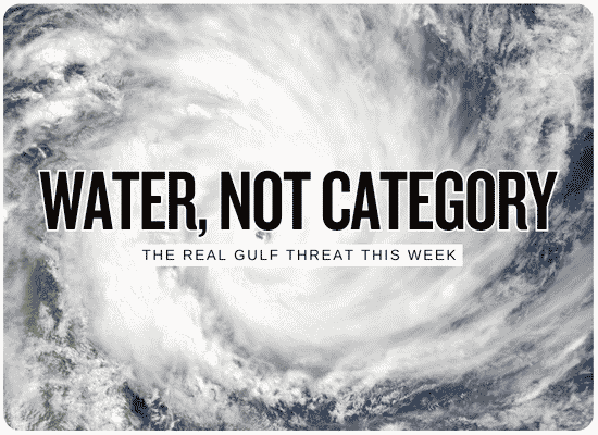
It Doesn’t Need to Become a Hurricane
A developing Gulf disturbance is getting the attention, but the more immediate homeowner problem is already here: deep tropical moisture, a stalled boundary and thunderstorms capable of dumping several inches of water faster than streets and drainage systems can handle it.
After you’ve watched Gulf weather for enough years, you learn not to wait for somebody to put a name on a storm before you start paying attention to the water. A hurricane category tells me plenty about wind. It tells me almost nothing about what a slow-moving thunderstorm can do to a neighborhood drain at two in the morning. This week is a good example. We have a tropical disturbance worth watching, but we also have something much less dramatic-looking and plenty capable of flooding property: a stalled boundary sitting in a very wet Gulf air mass.
In parts of the Florida Panhandle, that distinction is no longer theoretical. Flash flooding was already occurring Monday while the Gulf disturbance itself was still disorganized hundreds of miles away.
What Is Actually Happening
There are really two related Gulf stories unfolding at the same time.
A stalled front loaded with tropical moisture
A boundary has been draped across the Gulf Coast while extremely moist air feeds repeated thunderstorms. Where storms move slowly or repeatedly cross the same place, rainfall totals can pile up very quickly.
AL92 in the southwestern Gulf
The National Hurricane Center is monitoring a low-pressure trough that may become a tropical depression around midweek. Its eventual track and northern Gulf impacts remain uncertain.
AL92 had a 60% chance of developing within 48 hours and an 80% chance within seven days. NHC said a tropical depression is expected to form during the middle part of the week, but it remains too early to determine specific northern Gulf Coast impacts.
The Flood Threat Didn’t Wait for AL92
Flash flooding was occurring in the Florida Panhandle Monday.
In a flash-flood warning covering parts of Calhoun and Jackson counties, the National Weather Service reported roughly 2.5 to 3.5 inches had already fallen, with another 2 to 3 inches possible. Streets, highways, underpasses, creeks and low-lying areas were specifically listed as vulnerable.
That follows several days of heavy rainfall along sections of the central and eastern Gulf Coast. Flood watches stretched across portions of Alabama, the Florida Panhandle and south Georgia, where already-wet ground meant additional rainfall could create problems faster.
The disturbance in the southwestern Gulf is the headline. The atmosphere around it is the homeowner problem. A property can flood from moisture feeding into a stalled boundary even if the tropical disturbance never reaches hurricane strength — or never becomes a hurricane at all.
Why This Setup Can Produce So Much Water
| Ingredient | What’s Happening | Why It Matters for Flooding |
|---|---|---|
| Deep Gulf moisture | Atmospheric moisture levels are unusually high, with precipitable-water values near 2.25 inches possible in the late-week setup. | Thunderstorms have a deep reservoir of moisture available to convert into intense rainfall. |
| Stalled boundary | A front has slowed or stalled near the Gulf Coast. | Instead of sweeping storms away quickly, the pattern can keep redevelopment focused over the same general corridor. |
| Warm Gulf | Warm Gulf water supports abundant moisture and instability. | That helps maintain thunderstorms with tropical-style rainfall efficiency. |
| Training storms | Multiple thunderstorms can travel repeatedly across the same location. | Three separate one-inch bursts can become a three-inch neighborhood flood even if no single storm looks extraordinary. |
| Wet ground | Some areas have already received several rounds of rain. | As soil absorbs less water, a larger percentage of new rainfall becomes runoff. |
| Urban drainage | Heavy tropical rainfall can arrive faster than storm drains can remove it. | Street and property flooding can occur well away from rivers and mapped coastal surge zones. |
Rain Rate Is the Number I’d Watch
Total rainfall gets most of the attention, but homeowners should also pay attention to how quickly the rain is falling.
That kind of burst can overwhelm drainage before a daily rainfall total looks extraordinary.
WPC said localized peak rainfall rates of 2 to 3 inches or more per hour were possible Monday in parts of southeast Alabama, southwest Georgia and the Florida Panhandle. Later-week guidance also supports the possibility of 2–3 inch-per-hour rates where the best moisture and thunderstorms line up.
A neighborhood storm-drain system does not care whether the rain comes from a Category 2 hurricane, a tropical depression or an unnamed thunderstorm. If water arrives faster than the system can carry it away, the street starts becoming the drainage system.
Why Hurricane Category Can Be a Distraction
The Saffir-Simpson scale measures wind — not rainfall flooding.
The National Hurricane Center explicitly says hurricane categories are based only on maximum sustained wind. The scale does not account for rainfall flooding, storm surge or tornadoes. A weak tropical system can therefore produce a serious flood disaster, while a stronger hurricane moving quickly through an area might produce less rainfall at one particular location.
Instead of asking, “What category will it be?” ask: How much rain could fall here, how quickly could it fall, how wet is the ground already, and where does the water go when the drainage system fills up?
How the Next Several Days Could Unfold
Flash flooding is already occurring.
Parts of the Panhandle have received several inches of rain, with active flood advisories and flash-flood warnings. The immediate problem is tropical moisture interacting with the stalled Gulf Coast pattern.
AL92 drifts east while the boundary remains nearby.
NHC expects gradual organization and says a tropical depression could form around midweek. Exact movement and impacts remain uncertain.
Heavy-rain ingredients remain in place.
WPC’s extended outlook shows a continued excessive-rainfall concern for portions of the Gulf Coast, with very moist air capable of supporting intense rainfall rates where thunderstorms organize.
Northern Gulf impacts depend on how the disturbance evolves.
Track, strength and timing remain low-confidence this far out. Rainfall can spread well away from the eventual low-pressure center, so watching only a forecast track line can miss the broader water threat.
NOAA still sees a broader wet pattern.
The Climate Prediction Center highlights a risk of heavy precipitation from parts of the upper Texas coast through the Lower Mississippi Valley and Southeast, with flooding possible across much of the Gulf Coast region.
What Would Make the Flood Threat Worse?
Slower movement
The longer a moisture plume or tropical low remains near the same part of the coast, the greater the opportunity for rainfall totals to stack up.
Repeated storms
Radar showing thunderstorms repeatedly moving over the same corridor is often more concerning for flash flooding than one isolated heavy cell.
Higher rain rates
Hourly rainfall approaching two or three inches can produce trouble quickly in cities, subdivisions and other poor-drainage locations.
Rain before the main event
Every round that arrives first can reduce the ground’s ability to absorb the next round.
Nighttime timing
Flooded roads and rapidly changing water levels are much harder to recognize after dark.
Official risk upgrades
Flood Watches, Flash Flood Warnings and changes in WPC excessive-rainfall categories deserve more attention than social-media speculation about a future storm category.
The Four Forecasts Homeowners Should Actually Watch
Shows where forecasters believe rainfall may exceed local flash-flood guidance. Categories run Marginal, Slight, Moderate and High.
A Flood Watch means conditions are favorable. A Flash Flood Warning means flooding is occurring, imminent or strongly indicated.
Useful for tracking AL92’s development probability and eventual movement — but it should not replace the rainfall forecast.
Three inches falling onto dry ground and three inches falling after a wet weekend can produce very different runoff.
Look for repeated heavy cells crossing the same location rather than focusing solely on where the center of a tropical disturbance sits.
Standing water in streets, full ditches and drains that are already backing up are useful local signals that available capacity is disappearing.
If You’re Along the Gulf Coast, Do These Before the Forecast Gets Worse
Don’t Guess at Water Depth
The National Weather Service’s flood-safety guidance gives three numbers worth remembering.
Fast-moving water can knock an adult off his or her feet.
Moving water can carry away many passenger cars.
Moving water can carry away many SUVs, vans and trucks.
The depth you can see is only part of the risk. Floodwater can conceal a washed-out road, damaged pavement, open drainage structure or stronger current than it appears to have.
What Changes the Story From Here
| If This Happens… | What It Means | What I’d Watch Next |
|---|---|---|
| AL92 never organizes much | The wind threat may remain limited, but tropical moisture can still produce flooding. | WPC rainfall outlooks and local Flood Watches. |
| A tropical depression forms | A better-defined circulation may focus moisture and rainfall into a more organized pattern. | Track trends, forward speed and where the heaviest rain bands set up. |
| A named tropical storm forms | Wind and coastal impacts may increase, but the storm name itself does not determine rainfall severity. | NHC advisories plus local rainfall and flood forecasts. |
| Storm stalls near the coast | Flood concern increases sharply because heavy rain may persist over the same drainage basins. | Multi-day rainfall totals, rivers and repeated radar training. |
| System moves quickly | Rainfall duration may decrease at any one location, though intense bands can still cause flash flooding. | Hourly rainfall rate and local warnings. |
| More rain arrives before AL92 | Ground and drainage systems begin the later event with less available capacity. | Standing water, stream levels and prior 48–72 hour rainfall. |
Forecast material checked for this report
National Hurricane Center — Atlantic Tropical Weather Outlook, October 5, 2026.
NOAA Weather Prediction Center — Excessive Rainfall Outlooks, Extended Forecast Discussion and Mesoscale Precipitation Discussions, October 4–5, 2026.
NOAA Climate Prediction Center — U.S. Week-2 Hazards Outlook issued October 4, 2026.
National Weather Service Tallahassee, Mobile/Pensacola and New Orleans/Baton Rouge — flood watches, flash-flood warnings and forecast discussions.
National Hurricane Center — Saffir-Simpson Hurricane Wind Scale.
National Weather Service — Turn Around Don’t Drown flood-safety guidance.
48-Hour Flood Pressure Check
This is a quick preparedness screen, not a flood forecast. Enter the conditions around your property to see whether several common flash-flood ingredients are beginning to stack together.