
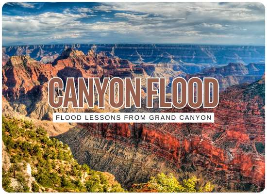
The Grand Canyon flash flood turned a remote waterline failure into a much larger infrastructure lesson. When nearly all creek footbridges are gone, trails are closed, lodging is halted, emergency water conservation begins, and the main utility corridor is damaged, the problem is no longer “a pipe broke.” The problem is that the entire operating system had too much dependence on one vulnerable corridor.
The Grand Canyon lesson in one sentence
Critical infrastructure is only as resilient as its weakest crossing, access route, backup supply, repair path, and operating plan during the exact conditions that damage it.
The Grand Canyon setting is extreme, but the lesson is not limited to national parks. Many flood-prone communities have similar vulnerabilities in less dramatic form: one water main under a creek, one electrical feed into a neighborhood, one bridge to a treatment plant, one lift station near a ditch, one culvert protecting a road, one pump station with no dry access, one emergency-water contract that has never been tested.
Stop asking only whether the asset can survive a flood. Ask whether the community can operate, repair, reroute, and supply people after the asset fails.
8 infrastructure lessons for flood-prone communities
The Grand Canyon event turns several abstract infrastructure terms into practical questions local leaders can act on.
01Single points of failure deserve a public name
If one pipe, bridge, pump station, treatment plant, electrical feed, access road, or culvert can shut down lodging, water service, emergency response, or fire protection, it should be listed as a named single point of failure. The point is not blame. The point is visibility.
Single point Board-level issue02Buried utilities are not automatically protected
A buried line can still be exposed by scour, debris impact, channel migration, landslides, bank failure, bridge washout, or erosion around supports. Flood-prone communities should inspect buried utility crossings as hydraulic assets, not just utility assets.
Scour risk Creek crossings03Redundancy must be functional, not theoretical
A backup well, second tank, temporary interconnect, emergency bypass, tanker route, alternate intake, portable treatment unit, or neighboring utility connection only counts if it can operate under flood conditions. Redundancy on a diagram is not the same as redundancy during a disaster.
Redundancy Test required04Access is part of the utility system
The Grand Canyon event shows that destroyed footbridges and closed trails can matter as much as pipe damage. If crews cannot reach valves, joints, pumps, tanks, intakes, or damaged segments, the asset is effectively less repairable than it appears.
Access loss Repair delay05Emergency water must be planned before conservation starts
When a main supply fails, conservation measures are only the first layer. Communities need preplanned bottled-water distribution, tanker access, priority service for medical needs, fire-suppression planning, commercial-use rules, and public messaging that people can understand quickly.
Emergency water Public health06Rerouting should be engineered before the outage
A reroute plan is not just a line on a map after the flood. It includes valves, pressure zones, pipe diameter, treatment capacity, temporary pumping, power supply, rights-of-way, road access, permitting, and materials staged where crews can actually use them.
Rerouting Pressure zones07Tourism and critical utilities are linked
The Grand Canyon lodging shutdown shows that a water utility failure can quickly become an economic disruption. Resorts, parks, campuses, small downtowns, coastal towns, and tourism districts should model water outage impacts on lodging, restaurants, restrooms, events, fire protection, and visitor safety.
Lodging disruption Visitor economy08Post-flood repairs should update the design standard
Rebuilding the same corridor the same way after a flood can preserve the original weakness. Communities should use the damage map to update freeboard, burial depth, armoring, bridge supports, access paths, valve locations, materials, monitoring, and emergency bypass design.
Build back stronger Design updateSingle point of failure audit
The first useful exercise is to list the assets whose failure would force service restrictions, closures, evacuations, or emergency water distribution.
| Asset | Failure consequence | Flood question | Better resilience move |
|---|---|---|---|
| Only water main | Water restrictions, lodging closure, business disruption, fire-flow concern | Does one crossing or corridor control the whole system? | Interconnect, parallel line, storage, bypass, tanker plan |
| Only bridge to facility | Crews cannot reach treatment plant, pump station, or repair zone | Can the route survive floodwater, debris, and washout? | Alternate access, staging area, temporary bridge plan, helicopter or boat contingency |
| Creek utility crossing | Pipe exposure, breakage, contamination risk, loss of pressure | Can scour expose or undermine the crossing? | Scour analysis, deeper burial, casing, armoring, relocation, sensors |
| Electrical feed | Pumps, controls, communications, and treatment stop working | Are panels, generators, transfer switches, and fuel protected? | Backup power, elevated controls, fuel plan, electrical hardening |
| Storage tanks | Community has only limited water after supply failure | How many hours or days can the system operate without inflow? | More storage, demand restrictions, priority-use rules, refill logistics |
| Valve network | Crews cannot isolate damage or reroute service quickly | Are valves accessible, mapped, tested, and operable in flood conditions? | Valve exercising, GIS maps, above-flood markers, isolation drills |
Flood infrastructure single-point risk score
Use this planning tool to estimate whether a community, campus, resort, park, or utility has Grand Canyon-style single-point exposure. It is not an engineering report, water-quality decision, or emergency declaration tool.
Score logic: single-corridor dependence, flood crossings, access, emergency water, and rerouting readiness are combined into a 100-point planning score. User-days multiply affected users by estimated restriction days.
Buried utilities need flood-specific inspection
A buried utility crossing can fail even when the pipe material itself is strong. Floodwater changes the ground around the pipe. It can scour away cover, move boulders and debris, undermine banks, expose supports, break adjacent access paths, and make repairs too dangerous to perform quickly.
| Inspection target | Flood damage clue | Resilience upgrade |
|---|---|---|
| Creek crossing burial depth | Exposed pipe, shallow cover, bank erosion, shifting channel | Deeper crossing, casing, bank stabilization, relocation outside active channel |
| Pipe supports and anchors | Undermined supports, debris impact, displaced structures | Armored supports, debris-resistant design, redundancy at crossing |
| Valves near flood path | Valves submerged, buried, inaccessible, or unmapped after damage | Accessible valve vaults, above-flood markers, GIS location, exercising program |
| Adjacent footbridges or roads | Utility survives but access crossing fails | Separate repair access from pedestrian or public-access infrastructure |
| Telemetry and alarms | Break not recognized quickly or pressure loss location unclear | Pressure sensors, flow monitoring, isolation alarms, satellite or radio backup |
| Spare parts and staging | Pipe, couplings, valves, and equipment unavailable in remote conditions | Preposition repair materials outside flood zone and identify transport method |
Emergency water plan for the first 72 hours
Water restrictions are important, but they are not the whole plan. A community that loses its main waterline needs a first-72-hour playbook.
- 01 Identify priority users: residents, medical needs, emergency crews, food service, sanitation, fire protection, schools, lodging, and vulnerable populations.
- 02 Calculate stored water: tanks, reservoirs, pressure zones, bottled water, tankers, wells, and neighboring interconnects.
- 03 Publish use restrictions quickly: drinking, flushing, showers, laundry, vehicle washing, food service, lodging, irrigation, construction, and commercial uses.
- 04 Preselect distribution sites that can handle traffic, night operations, ADA access, tanker access, and public safety.
- 05 Create a refill plan for remote users who cannot drive or carry water.
- 06 Coordinate with fire agencies if flow, pressure, or storage may affect suppression capability.
- 07 Prepare boil-water, do-not-use, conservation, and restoration message templates before the failure.
- 08 Keep water-quality testing, flushing, and public clearance procedures ready for restoration.
Rerouting and bypass design checklist
Rerouting is often discussed too late. Communities should know the emergency bypass options before the main corridor is underwater.
| Reroute element | Question to answer before the flood | Common weak spot |
|---|---|---|
| Isolation valves | Can damaged sections be isolated without shutting down the whole system? | Valves are stuck, buried, unmapped, or inside floodwater |
| Pressure zones | Will rerouted water maintain safe pressure without damaging pipes? | Hydraulic plan exists only in theory |
| Temporary pumping | Are pumps, hoses, fuel, fittings, power, and operators available? | Equipment cannot reach the site or lacks compatible fittings |
| Interconnects | Can a neighboring system provide emergency water? | Flow capacity, water quality, metering, pressure, or agreement issues |
| Alternate supply | Can wells, tanks, intakes, or hauled water carry minimum demand? | No tested demand-reduction plan |
| Permits and rights-of-way | Can temporary pipe or access be installed legally and quickly? | Environmental, land ownership, or historic-resource constraints delay response |
| Public communication | Can the public understand who has water, who does not, and what uses are restricted? | Confusing message causes overuse, rumors, or unsafe behavior |
Access failure may be the hidden disaster
The destruction of footbridges in Bright Angel Canyon is not a side detail. For remote infrastructure, a destroyed crossing can decide whether repairs happen today, next week, or after a much larger mobilization.
- 01 Map all repair access routes for water, wastewater, electrical, gas, communications, and road infrastructure.
- 02 Identify crossings likely to fail before the buried utility fails.
- 03 Pre-stage repair materials on both sides of vulnerable crossings when practical.
- 04 Create alternate access agreements with neighboring landowners, agencies, contractors, or emergency services.
- 05 Include temporary bridge, helicopter, boat, ATV, high-clearance, and pedestrian access options where relevant.
- 06 Train crews on safe post-flood access decisions, because unstable banks and debris fields can kill repair workers.
Tourism towns and park gateways need a utility-lodging model
The Grand Canyon lodging disruption is a reminder for mountain towns, beach towns, park gateways, resorts, campuses, and event districts. A waterline failure can reduce or eliminate overnight capacity even if the destination itself remains open to day visitors.
| Business function | Water outage impact | Preparedness move |
|---|---|---|
| Hotels and lodges | Rooms may close because toilets, showers, laundry, cleaning, and fire protection depend on water | Guest relocation plan, refund language, off-system lodging coordination |
| Restaurants | Food prep, dishwashing, ice, handwashing, and sanitation may be restricted | Health-department protocol, limited menu plan, bottled-water supply |
| Campgrounds | Restrooms, drinking water, showers, and sanitation become difficult | Dry-camping rules, portable sanitation, water-hauling plan |
| Emergency services | Fire suppression and medical response may depend on water storage and access | Priority storage, tanker support, mutual-aid planning |
| Visitor messaging | Unclear restrictions can create confusion, cancellations, unsafe behavior, and bad information online | Single official update page, closure map, lodging status, water-use instructions |
Community checklist after the Grand Canyon flood
Flood-prone communities do not need a canyon to have the same risk structure. Use this checklist to find the local version of the Transcanyon Waterline problem.
- 01 List every asset whose failure would force water restrictions, boil-water notices, lodging closure, business shutdown, evacuation, or emergency supply.
- 02 Identify every water, wastewater, power, and communications crossing at creeks, rivers, washes, ditches, culverts, beaches, and floodplains.
- 03 Map which access routes would disappear if bridges, footbridges, trails, low roads, or culverts failed.
- 04 Calculate storage time under emergency conservation: hours, days, and critical-use limits.
- 05 Test emergency water distribution and public messaging before the next flood season.
- 06 Create repair material lists for pipe, valves, couplings, generators, pumps, hoses, fuel, fittings, telemetry, and water-quality testing.
- 07 Review whether the emergency reroute can actually meet demand, pressure, quality, and access requirements.
- 08 After any flood, update the hazard map with real debris paths, scour zones, bridge losses, access failures, and utility breaks.
The practical infrastructure takeaway
The Grand Canyon flash flood shows that flood damage to infrastructure is rarely isolated. A broken pipeline can become a lodging shutdown. A destroyed footbridge can become a repair-access failure. A washed-out corridor can become an emergency-water problem. A remote asset can become a public-safety issue. Flood-prone communities should treat utilities, access, redundancy, emergency supply, and rerouting as one system before the next high-water event tests them.