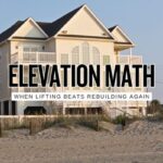
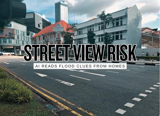
I would not use a Street View photo to decide whether a specific house will flood, but I would absolutely use it as a clue that the house deserves a closer look. A flood map can show the hazard around a property, but a street-level photo can sometimes show something just as important: whether the house is raised above the street, sitting close to grade, protected by steps, exposed through a low garage, or hiding a basement entry below the sidewalk line. New AI research is trying to turn those visual clues into usable property-level elevation data.
The photo clue flood models have been missing
Flood damage often depends on the height difference between outside water and the lowest occupied floor. A neighborhood may be mapped as exposed, but the house with a higher first floor may face less interior damage than the house with a low slab, sunken garage, basement window well, or first step only inches above grade.
The research direction is simple in concept but difficult in practice. AI looks at street-level imagery, detects visible building features, estimates the relationship between the road or ground and the first-floor entry, then combines that clue with flood depth data, terrain, and building information. The result is not “this home will flood.” The better result is “this home may have less or more interior exposure than a map alone suggests.”
Flood risk analysis is moving from “Is the parcel in the floodplain?” toward “How high is the actual living floor above the water path?”
The new AI workflow in plain terms
The strongest recent studies are not just asking a model to guess flood risk from a pretty house photo. They are trying to extract a measurable vertical clue from the image.
01Find the house facade
The model starts with street-view imagery and attempts to isolate the front-facing structure. This step can be messy because trees, cars, fences, porches, shadows, old photos, and angled camera views can hide the real entry point.
02Detect doors, stairs, road edges, and ground references
The system looks for visible features that help anchor vertical measurement. A front door, door bottom, stair run, porch edge, driveway, curb, or road edge can help estimate the height difference between street grade and the first usable floor.
03Estimate first-floor or lowest-floor elevation
Using image geometry, depth information, and detected objects, the model estimates the vertical relationship between the floor and nearby grade. In research terms, this is often described as first-floor height, lowest-floor elevation, or the height difference between street grade and the lowest floor.
04Fill gaps only when the model is defensible
Street View is not available or usable for every parcel. Some newer work uses machine-learning imputation to estimate missing values from terrain, hydrologic, geographic, and exposure features, but it only keeps those predictions in areas where performance is strong enough.
05Combine the elevation clue with flood depth
The real power comes when the first-floor estimate is paired with flood depth surfaces. A property with expected outdoor flood depth of 2 feet is very different if the lowest floor is 3 feet above the street versus almost level with the street.
Street View signals that may change a flood read
These are the visible clues AI models and human buyers both care about. The difference is that AI can scan thousands of photos quickly, while humans still need to verify individual properties carefully.
| Visible signal | Potential flood meaning | Helpful for AI | Human follow-up |
|---|---|---|---|
| Raised entry steps | First floor may sit above street or yard grade | Door bottom and steps can provide vertical reference | Request Elevation Certificate or survey data |
| Low slab | Little separation between water outside and finished floor inside | Door threshold and ground line may be visible | Inspect grade, drainage, door thresholds, and flood history |
| Garage nearly level with driveway | Garage may be first entry point even if living floor is higher | Driveway and garage opening are visible in many images | Check contents exposure, utility location, and driveway slope |
| Basement windows | Lower-level space may be exposed to window-well flooding or seepage | Basement windows can help classify building vulnerability | Inspect window wells, drains, sump pump, and water backup coverage |
| Porch or deck height | May suggest floor elevation, but can also mislead if porch is not tied to interior floor | Useful when paired with door detection | Verify inside floor level, not just porch appearance |
| Street crown and curb height | Street drainage pattern may affect shallow flooding and access | Road edge helps create a vertical reference | Visit during rain or review local drainage history |
| Below-grade entry | Stairwell or sunken entry can collect water quickly | May be visible if not hidden by landscaping or walls | Inspect drains, covers, pumps, and emergency overflow path |
Street View flood clue score
Use this tool as a buyer or homeowner screening aid. It does not predict a flood and does not replace FEMA maps, Elevation Certificates, surveys, inspections, or insurance quotes.
Score logic: visible floor height, garage exposure, basement clues, drainage clues, photo confidence, and mapped flood concern are combined into a 100-point screening score. The cost signal combines annual flood insurance with an early verification or mitigation budget.
Strong uses for this AI research
Street-view elevation estimation is most valuable when a city, insurer, researcher, or buyer needs to prioritize which properties deserve closer investigation.
01Filling the Elevation Certificate gap
Elevation Certificates are useful, but many homes do not have one readily available. AI-based photo screening can help estimate which structures may have low first-floor height before a survey is ordered.
02Ranking mitigation outreach
Local governments could use building-level elevation clues to identify neighborhoods where low first floors, basement entries, or low garages may create higher interior-damage risk.
03Improving loss estimates
Flood depth alone does not tell the whole damage story. Pairing expected outdoor water depth with estimated first-floor height can produce a more realistic picture of interior damage potential.
04Helping buyers ask better questions
A buyer can use Street View as a screening tool before touring a property. Low thresholds, below-grade entries, basement windows, and driveway slope can all become due-diligence questions.
05Supporting neighborhood-scale planning
At scale, street-view data can help communities move beyond broad floodplain labels and identify clusters of low-entry structures that may need drainage, elevation, buyout, barrier, or insurance outreach.
Weak spots that keep this from being a house-by-house answer
The research is promising, but a single property decision still needs caution. Street View is a screening layer, not a final verdict.
| Limitation | Risk to interpretation | Practical safeguard |
|---|---|---|
| Blocked view | Trees, cars, fences, hedges, porches, or shadows hide the real entry | Use multiple angles and verify on site |
| Outdated imagery | Renovations, elevation work, new drainage, or new fill may not appear | Check image date and ask for current photos |
| Wrong door assumption | A side door, porch door, garage door, or decorative door may not represent the lowest floor | Confirm the lowest finished floor with documents or inspection |
| Street grade mismatch | The road may not be the same elevation as the yard, drainage path, creek side, or rear of the property | Review survey, lot grading, drainage paths, and rear-yard elevation |
| Hidden basement risk | Basement windows, stairwells, floor drains, and sump systems may not be visible | Inspect inside and ask about seepage, backup, and sump history |
| Flood source difference | Rainfall, riverine, coastal, sewer backup, and groundwater risks do not behave the same way | Pair visual clues with local flood source and insurance review |
Buyer checklist using Street View without overtrusting it
A buyer can use this research direction right now, even without access to an AI model, by reading street-level images more carefully.
- 01 Look for the number of steps between sidewalk, driveway, or yard grade and the front door threshold.
- 02 Check whether the garage appears lower than the living area and whether the driveway slopes toward it.
- 03 Scan for basement windows, window wells, sunken entries, or lower-level doors.
- 04 Compare the house to neighboring homes. A house that sits visibly lower than both neighbors deserves extra attention.
- 05 Look for drainage features: swales, ditches, curb inlets, culverts, catch basins, and ponding-prone low spots.
- 06 Pull the FEMA map and ask for flood insurance pricing early, even if the photo looks reassuring.
- 07 Ask whether an Elevation Certificate exists and whether the first-floor height is known.
- 08 Visit after heavy rain if possible, because photos rarely show actual water behavior.
- 09 Use the image as a question generator, not as the final answer.
Insurance and planning implications
First-floor height matters because the damage question is vertical. Floodwater outside a home may be manageable if the living floor is high enough. The same outdoor water depth can become costly when the first finished floor is low, the garage is used for storage, or mechanical equipment sits near grade.
For cities and counties, this type of AI could help prioritize outreach. Instead of telling every homeowner in a floodplain the same thing, a community could identify lower-entry homes, older slab homes, basement clusters, or areas where street-level clues suggest greater interior exposure. For insurers and lenders, it could improve risk segmentation where official elevation data is missing. For homeowners, it can make the invisible visible: the first floor is not just a design detail. It is part of the flood defense system.
Better local flood decisions this research could support
The best version of this technology is not a scary online score that tells owners their house is doomed. It is a practical planning layer that helps communities spend limited mitigation money where it can reduce real damage.
| Decision area | Street-view elevation data could help | Still needed |
|---|---|---|
| Drainage projects | Identify homes where shallow street flooding may reach low floors | Hydraulic modeling, field survey, maintenance history |
| Grant targeting | Prioritize elevation, floodproofing, drainage, or acquisition outreach | Eligibility review, benefit-cost analysis, owner participation |
| Emergency planning | Find clusters of homes likely to experience interior flooding earlier | Local road closures, rainfall forecasts, vulnerable resident data |
| Insurance education | Explain why first-floor height changes risk even within the same flood zone | Policy quote, coverage review, Elevation Certificate when available |
| Real estate due diligence | Flag low-entry, basement, garage, or drainage clues before touring | Inspection, disclosure, survey, flood history, insurance quote |
The practical takeaway
Google Street View will not tell a homeowner exactly which house will flood next. The more useful takeaway is that visible building elevation matters and AI is getting better at extracting that clue at scale. A street-level photo can show whether the first floor is high, low, hidden, blocked, or potentially exposed. That makes it useful for screening, planning, insurance questions, and buyer due diligence. The final decision still belongs to official maps, Elevation Certificates, surveys, inspections, flood history, local drainage records, and real insurance quotes.