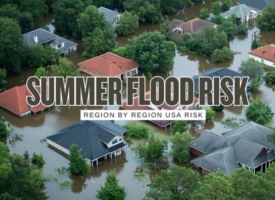
The summer 2026 flood outlook for the United States is not shaping up like one clean national story. The official federal backdrop points to a split pattern: the Climate Prediction Center favors above-normal precipitation for most Atlantic Coast states into the eastern Gulf region and the Lower Four Corners, while below-normal precipitation is favored from the Pacific Northwest into northern and central parts of the Intermountain West and Rockies and across parts of the central Great Plains. At the same time, CPC says El Niño is likely to emerge during May-July 2026 and persist through at least the end of the year, while NOAA’s National Hurricane Center says there are no Atlantic tropical cyclones right now and that the Atlantic hurricane season runs from June 1 through November 30. That combination matters because it suggests this summer’s flood story will be driven less by one coast-to-coast signal and more by distinct regional setups.
This summer’s flood outlook looks regional, uneven, and highly dependent on how local water pathways behave
The broad federal setup for summer 2026 points to a split pattern rather than one clean national flood story. The Climate Prediction Center favors above-normal precipitation for most Atlantic Coast states into the eastern Gulf region and the Lower Four Corners, while below-normal precipitation is favored from the Pacific Northwest into parts of the interior West and central Great Plains. At the same time, the official ENSO discussion says El Niño is likely to emerge during May to July 2026 and persist through at least the end of the year.
That combination matters because it suggests this summer’s flood story will be driven less by one coast-to-coast signal and more by distinct regional setups. In one part of the country, flood danger may be driven by repeated rain and overwhelmed drainage. In another, it may be driven by monsoon bursts and terrain. In another, the broad signal may look quieter even while localized flash flooding remains very real.
Summer 2026 flood signals at a glance
| Signal | Current federal read | Flood takeaway |
|---|---|---|
| Atlantic Coast and eastern Gulf rainfall | Above-normal precipitation favored | Repeated rain and drainage stress look more likely |
| Lower Four Corners rainfall | Above-normal precipitation favored with a robust monsoon expectation later in summer | Flash-flood sensitivity rises in washes, canyons, urban corridors, and burn-scar zones |
| Pacific Northwest and interior West | Below-normal precipitation favored in broad areas | Lower broad flood pressure, but local terrain risk remains |
| Central Great Plains | Below-normal precipitation favored in parts of the region | Broad seasonal pressure may be lower, but localized storm flooding still matters |
| Atlantic tropical status right now | No Atlantic tropical cyclones currently active | Early-summer flood concern is still more about rainfall patterns than active named storms |
Region by region summer flood outlook for 2026
Each region below is broken into its own flood story, because that is the only way this summer really makes sense.
Southeastern United States
One of the clearest summer flood watch regions because rain stacking matters here even before a named storm does
Seasonal signal
The Southeast deserves serious flood attention this summer because the official CPC summer outlook places above-normal precipitation odds over much of the Atlantic Coast into the eastern Gulf region. That alone raises the odds of repeated heavy-rain periods rather than one isolated flood event.
Main flood pattern to watch
For the Southeast, the biggest issue is not simply hurricane or no hurricane. It is repeated rain pushing local drainage, neighborhood stormwater systems, small streams, low roads, and poorly graded lots past their comfort zone. Streets flood first. Water ponds in low corridors. Garages and low entries start taking water. The flood story here often starts small and local before it looks like a broader event.
Tropical angle later in the season
The Atlantic hurricane season officially runs from June 1 through November 30, according to the National Hurricane Center. Even without a current storm in the basin, this region still carries a higher flood ceiling later in summer if tropical moisture begins interacting with an already wetter background.
Best regional read
The Southeast looks like a repeated-rain vulnerability zone with tropical upside risk layered on top. It does not need a major named storm to have a bad flood summer.
Northeast and Mid-Atlantic
A region where repeated heavy rain, urban runoff, and drainage bottlenecks can matter more than major-river headlines
Seasonal signal
The Mid-Atlantic and parts of the broader Northeast sit inside one of the more consequential wetter-leaning summer zones because the Atlantic Coast is favored for above-normal precipitation in the official CPC outlook, and the longer discussion keeps the southern Mid-Atlantic on the wetter side into later summer windows.
Main flood pattern to watch
This region’s flood story is often about repeated storm systems, urban impervious surfaces, basement exposure, overwhelmed local drains, and sewer-related flooding in older neighborhoods. A wetter seasonal background can make all of these problems show up more often, especially in built-up corridors where runoff moves quickly and storage capacity is thin.
The hidden vulnerability
A lot of owners in this region do not think of themselves as having a flood problem because they are not next to a major river. That is exactly why repeated summer rain can be so deceptive here. Street ponding, basement seepage, and sewer backup often matter more than classic river imagery.
Best regional read
This region looks like a runoff-and-basement flood story more than a broad large-river summer story, especially in the southern Mid-Atlantic and dense metro areas.
Midwest and Great Lakes
Not the strongest broad seasonal signal, but still one of the easiest places to underestimate storm-driven flood damage
Seasonal signal
The Midwest does not sit inside the boldest national wet signal this summer. Much of the region is closer to equal-chances territory than to a sharp above-normal precipitation call in the seasonal CPC map. That makes it easy to read the region too casually.
Main flood pattern to watch
The Midwest can still have a very expensive flood summer through training thunderstorms, short-duration intense rainfall, small-basin response, agricultural runoff, and urban flash flooding. In this region, one organized storm corridor can matter more than the whole seasonal average for a given county or metro area.
The common mistake
The most common mistake here is assuming that a less dramatic seasonal signal means the flood problem has faded. It has not. The Midwest still rewards short-range vigilance more than broad seasonal comfort.
Best regional read
This region looks moderate in the seasonal view but still highly capable of sharp local flood damage when storm tracks align the wrong way.
Great Plains and Central Interior
Lower broad seasonal flood pressure does not mean short-burst flood danger disappears
Seasonal signal
The central Great Plains sit inside one of the drier broad zones in the official precipitation outlook, with below-normal precipitation favored across parts of the central Great Plains. The seasonal drought discussion still notes that organized convection can produce locally heavy rainfall and temporary relief even inside a broader dry setup.
Main flood pattern to watch
This region may have fewer broad flood alarms, but it remains vulnerable to intense storm-driven flooding when moisture, instability, and track alignment cooperate. Flash flooding at low-water crossings, creek jumps, rural road overtopping, and short-burst urban flooding remain very possible.
The common mistake
Drier seasonal language can lull people into treating flood planning as less urgent. That is the wrong takeaway. Broad dryness and local flood danger can still coexist very easily here.
Best regional read
The Plains look like a lower broad-pressure zone with still-real short-burst flood danger when the storm pattern turns violent enough.
Southwest and Four Corners
One of the clearest flash-flood regions of the entire summer because the monsoon signal matters here
Seasonal signal
This is one of the most important regions in the entire summer 2026 flood outlook. The official CPC discussion favors above-normal precipitation in the Lower Four Corners and explicitly says later summer periods are favored to be wetter there in expectation of a fairly robust monsoon setup.
Main flood pattern to watch
The flood danger in the Southwest is not mainly about long-lasting wetness. It is about very intense rainfall over terrain and built environments that respond badly. Washes, canyons, desert urban corridors, burn scars, low-water crossings, and normally dry channels can become dangerous with startling speed.
The common mistake
Dry landscapes feel safer to many people. In practice, they can be highly vulnerable to rapid runoff when heavy rain arrives faster than the ground and drainage routes can absorb it.
Best regional read
This region looks like one of the clearest high-sensitivity flash-flood zones of summer 2026, and the monsoon signal is a big reason why.
Pacific Northwest and Northern Rockies
Broad flood pressure looks lower, but drought, low snowpack, and terrain still leave selective risk
Seasonal signal
This region carries one of the clearest drier broad signals in the national outlook. The CPC outlook favors below-normal precipitation in the Pacific Northwest and parts of the northern Intermountain West and Rockies. The seasonal drought discussion also highlights drought expansion and very low snow-water equivalent in broad western mountain zones.
Main flood pattern to watch
The lower broad flood pressure reduces the chance that this region becomes one of the main national flood headlines. But terrain-driven flash flooding, burn-scar runoff, and isolated intense storms can still produce significant local losses in exactly the basins that have the least margin for fast runoff.
The common mistake
The mistake here is assuming that a drier seasonal outlook means flood planning can be ignored. It should not be ignored. It should simply become more targeted and geography-specific.
Best regional read
This region looks quieter at the broad seasonal scale, but still dangerous in pockets where terrain or wildfire scars magnify runoff.
California and Nevada
Not a dominant national flood headline this summer, but still vulnerable where local geography narrows the margin
Seasonal signal
California and Nevada sit inside a broader western setup that is being shaped more by drought persistence and expansion concerns than by a strongly wet summer pattern. The seasonal drought discussion says drought expansion is favored in portions of California and Nevada that are already abnormally dry.
Main flood pattern to watch
The broad seasonal flood ceiling looks lower than in the Southeast or Southwest monsoon corridor, but that does not erase localized risk. Burn scars, foothill channels, urban hardscape, and isolated thunderstorms can still translate a local rainfall event into damaging runoff and debris issues.
The common mistake
The mistake here is thinking that because the statewide story is not broadly wet, the property-level flood story must be quiet too. That is often not true in selective foothill, canyon, and burn-scar settings.
Best regional read
California and Nevada look like selective-caution regions this summer, not broad flood-alarm regions, but the wrong local setup can still produce a very expensive event.
Regional ranking board
| Region | Summer 2026 tone | Main flood style | Best planning focus |
|---|---|---|---|
| Southeast | Elevated watchfulness | Repeated rain, drainage overload, tropical moisture later | Drainage readiness and low-entry exposure |
| Northeast and Mid-Atlantic | Watchful with southern corridor strength | Urban runoff, basements, repeated rain pressure | Street drainage and sewer exposure |
| Midwest and Great Lakes | Localized event risk | Training storms and small-basin flooding | Short-range weather discipline |
| Great Plains | Lower broad pressure, still storm-sensitive | Localized flash flooding from convection | Crossings, creeks, runoff channels |
| Southwest and Four Corners | High flash-flood sensitivity | Monsoon bursts, washes, canyons, burn scars | Terrain-aware local planning |
| Pacific Northwest and northern Rockies | Lower broad signal | Selective terrain and burn-scar flooding | Targeted local caution |
| California and Nevada | Selective caution | Localized runoff and foothill or burn-scar exposure | Site-specific vulnerability review |
Regional summer flood focus tool
This tool does not replace a forecast. It helps identify which type of summer flood planning likely deserves the most attention for your region and property.