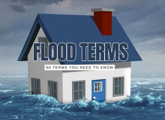
Flood talk gets confusing fast. “Hundred-year” doesn’t mean once a century, “freeboard” isn’t a skateboard trick, and half the acronyms look the same. This guide translates the most common (and most misused) flood terms into plain English with quick examples and why they matter for real homes, streets, and budgets.
1% Annual Chance Flood (“100-Year Flood”)
ProbabilityDefinition: A flood with a 1% chance of being equaled or exceeded in any given year. It can happen more than once in a lifetime.
Importance: Many rules, maps, and insurance prices are based on this benchmark.
Base Flood (BF)
BenchmarkDefinition: The specific 1% annual-chance flood used for mapping and building standards.
Importance: Sets design targets for new/renovated buildings in risky areas.
Base Flood Elevation (BFE)
ElevationDefinition: The water surface height (relative to a survey datum) reached by the base flood.
Importance: First-floor elevation vs. BFE strongly influences insurance cost and code requirements.
Freeboard
Safety MarginDefinition: Extra height (often +1–3 ft) above BFE to hedge against uncertainty and waves.
Importance: Low-cost way to reduce damage and premiums; often required by local codes.
SFHA & Flood Zones (AE, VE, X)
MappingDefinition: Special Flood Hazard Area (≥1% risk). AE = stillwater flooding; VE = coastal with waves; X = lower risk.
Importance: Lenders may require insurance in SFHAs; VE zones have stricter build rules.
Floodway vs. Floodplain (Fringe)
RiversDefinition: Floodway = channel + fast-flow area needed to carry the base flood; Fringe = shallower overflow areas.
Importance: Building in the floodway is highly restricted due to velocity and blockage risks.
FIRM (Flood Insurance Rate Map)
MapDefinition: Official map showing flood zones, BFEs, and floodways.
Importance: Determines insurance requirements and local building standards.
LOMA / LOMR
Map ChangeDefinition: Letter of Map Amendment (LOMA) or Revision (LOMR) to correct or update FIRMs.
Importance: Can remove a home from SFHA (and lender insurance requirement) or update BFEs.
Elevation Certificate (EC)
DocumentationDefinition: Surveyed form showing a building’s elevations relative to BFE.
Importance: Supports accurate insurance rating and code compliance.
Datum (e.g., NAVD88)
ReferenceDefinition: The vertical reference system used for elevations.
Importance: Ensures apples-to-apples comparisons between BFE, surveys, and maps.
Lowest Floor
Building TermDefinition: The floor used for rating—often the top of the lowest enclosed area (with rules for enclosures).
Importance: Drives premiums; enclosing space below BFE can raise costs.
Substantial Improvement / Damage (50% Rule)
Code TriggerDefinition: When repairs or upgrades ≥ ~50% of market value, the building must meet current flood codes.
Importance: Can require elevation or floodproofing during big renovations.
CRS (Community Rating System)
DiscountsDefinition: Voluntary program where towns earn points for better flood practices.
Importance: Residents get automatic insurance discounts in CRS communities.
Risk Rating 2.0
Insurance MethodDefinition: Modernized NFIP pricing that uses multiple risk factors (distance to water, elevation, foundation type, etc.).
Importance: Premiums better reflect individual property risk, not just zone.
Deductible
Insurance CostDefinition: Amount you pay out of pocket before insurance coverage begins.
Importance: Higher deductibles lower premiums but increase what you owe after a flood.
Waiting Period
ActivationDefinition: Time between purchase and coverage start (NFIP commonly ~30 days).
Importance: You can’t buy the day before a storm and be covered.
Replacement Cost vs. Actual Cash Value
ClaimsDefinition: Replacement Cost = new for old; ACV = depreciated value.
Importance: Policy type changes payout size—big deal for major losses.
Mitigation
Risk ReductionDefinition: Actions that reduce future flood damage (elevate, floodproof, relocate).
Importance: Can cut premiums and disaster downtime; sometimes grant-eligible.
Dry vs. Wet Floodproofing
Building MethodDefinition: Dry keeps water out (seals/barriers). Wet allows water in but minimizes damage (vents, flood-resistant materials).
Importance: Choice depends on building type, depth, and code limits.
Backflow Preventer (Check Valve)
PlumbingDefinition: One-way valve that stops sewage or stormwater from backing into a home.
Importance: Critical in low areas where mains surcharge during storms.
Sump Pump & Battery Backup
BasementsDefinition: Pump removes water from a pit; backup keeps it running during outages.
Importance: Prevents basement flooding when power fails—the most common time.
Foundation Types (Slab, Crawlspace, Pier)
StructureDefinition: How a home meets the ground—affects lowest floor and water pathways.
Importance: Different types have different code/mitigation requirements and premiums.
Flood Vents
Pressure ReliefDefinition: Openings that let water flow through enclosed areas to equalize pressure.
Importance: Prevents wall collapse and can improve insurance rating for enclosures.
Scour
ErosionDefinition: Removal of soil around foundations/bridge piers by fast water.
Importance: Undermines structures; dictates deeper footings or protection.
Erosion Setback
Coast & RiverDefinition: Required distance from eroding banks or shorelines.
Importance: Reduces long-term loss risk and protects natural buffers.
LiDAR & Elevation Models
DataDefinition: Laser-based mapping used to build detailed ground elevation models.
Importance: Improves flood mapping accuracy and site planning.
Storm Surge vs. Riverine vs. Pluvial
Hazard TypesDefinition: Surge = coastal water pushed inland; Riverine = rivers/streams overflow; Pluvial = intense rain overwhelms drainage away from rivers.
Importance: Different defenses and maps apply to each hazard.
Freeboard Credit (Insurance)
Premium ImpactDefinition: Premium reductions for building above BFE.
Importance: Each added foot can meaningfully reduce annual cost.
Levee Accreditation / PAL
Protection StatusDefinition: FEMA recognizes (or “provisionally accredits”) levees that meet standards.
Importance: Affects mapped risk and insurance, but residual risk remains behind levees.
No-Rise Certification
Floodway RuleDefinition: Engineer’s proof that a project in the floodway won’t increase base flood heights.
Importance: Required for many floodway projects to avoid worsening neighbors’ risk.
CLOMR / LOMR-F
Map Change (Fill)Definition: Conditional Letter/Letter of Map Revision based on fill; requests FEMA to revise a FIRM when land is raised above BFE.
Importance: Can change a property’s zone/insurance requirement—but must prove no harmful effects.
Compensatory Storage
HydraulicsDefinition: Replacing lost floodplain volume (due to fill) with equal volume nearby at similar elevations.
Importance: Prevents raising flood levels on neighbors.
No Adverse Impact (NAI)
Policy PrincipleDefinition: Managing development so it doesn’t increase flood risk to others (upstream/downstream/adjacent).
Importance: Guides permits, design, and community standards.
Coastal A Zone (CAZ)
Coastal MappingDefinition: Portion of Zone A near coasts with potential wave action (≈1.5–3 ft).
Importance: Often requires stronger, more “open” foundations (pile/piers) similar to V-zone practices.
V Zone (Velocity Zone)
Coastal WavesDefinition: High-risk coastal area with wave heights ≥3 ft during base flood.
Importance: Strictest building rules: open pile foundations, breakaway walls, no enclosures as living space.
AO / AH Zones
Shallow FloodingDefinition: AO = sheet flow with depths (e.g., 1–3 ft); AH = shallow ponding with a BFE.
Importance: Sets different elevation/rating rules than AE.
Backwater / Tailwater
HydraulicsDefinition: Water level downstream that pushes back into a channel or pipe, reducing outflow.
Importance: Causes street/yard flooding even without local rain; key for outfall design.
Nuisance / Sunny-Day Flooding
Tides & DrainageDefinition: Minor, frequent flooding during high tides or small storms.
Importance: Signals drainage/tidal issues and long-term sea-level rise exposure.
First-Floor Height (FFH)
Elevation MetricDefinition: Elevation of the first finished floor above the chosen datum.
Importance: Compared to BFE to set compliance and pricing.
Lowest Adjacent Grade (LAG)
Survey PointDefinition: The lowest ground next to the building foundation.
Importance: Used in map amendments and rating; if LAG > BFE, a LOMA may be possible.
Rating Curve (Stage–Discharge)
Rivers & CreeksDefinition: Relationship between water level (stage) and flow (discharge) at a gauge.
Importance: Translates forecasts into expected flood heights locally.
Return Period vs. AEP
Probability TermsDefinition: Return period (“100-year”) ≈ average interval; AEP = Annual Exceedance Probability (1% for “100-year”).
Importance: AEP is clearer—risk resets each year.
Design Storm
Engineering InputDefinition: A standardized storm size/duration used to design drains, culverts, etc.
Importance: If systems were sized for a 10-year storm, bigger events will overflow.
IDF Curves
Rain StatsDefinition: Intensity–Duration–Frequency charts showing how hard it can rain for how long and how often.
Importance: Core data for stormwater design and street flooding estimates.
PMP / PMF
Extreme EventsDefinition: Probable Maximum Precipitation / Flood—upper-bound theoretical extremes.
Importance: Used for dams and critical facilities where failure is unacceptable.
Overtopping
Barriers & RoadsDefinition: Water flowing over a levee, berm, road, or wall.
Importance: Even intact structures can allow damaging flows when crest is exceeded.
Sheet Flow vs. Channelized Flow
Surface WaterDefinition: Sheet = thin, broad flow over land; Channelized = concentrated in ditches/creeks.
Importance: Controls how to manage runoff—grading vs. culverts.
Depth–Damage Functions
Risk & CostDefinition: Curves estimating dollar loss as a function of water depth in a building.
Importance: Helps target cost-effective mitigation and insurance decisions.
Critical Facilities
Hospitals, UtilitiesDefinition: Sites that must remain operational (hospitals, fire stations, water plants).
Importance: Higher protection standards; often sited outside SFHAs or elevated.
Repetitive Loss (RL) / Severe RL
Claims HistoryDefinition: Properties with multiple paid flood claims (SRL = more severe/frequent).
Importance: Targeted for mitigation/buyouts; can face higher premiums.
Floodplain Ordinance
Local LawDefinition: Community rules governing development in mapped flood areas.
Importance: Determines permits, elevations, materials, and enforcement.
Variance (Floodplain)
Exception ProcessDefinition: Case-by-case relief from strict code requirements when unique hardship exists.
Importance: Limited and risky—can trigger higher premiums/liability.
Lowest Horizontal Structural Member
Coastal BuildDefinition: The lowest beam under a coastal building (on piles) used for elevation requirements.
Importance: Must be above BFE (or higher) in V/Coastal A zones.
Open vs. Enclosed Foundations
Structure & FlowDefinition: Open (piles/piers) allow water to pass; enclosed adds walls (with strict vent/breakaway rules).
Importance: Open types reduce forces and damage in wave/current zones.
Breakaway Walls
Coastal SafetyDefinition: Lightweight enclosure walls under elevated homes that are designed to fail under flood forces.
Importance: Prevents transferring wave loads into the structure.
Primary Frontal Dune (PFD)
Coastal FeatureDefinition: The first major dune ridge inland from the beach.
Importance: Often protected; controls V-zone limits and building setbacks.
Wave Setup & Runup
Coastal ForcesDefinition: Setup = average water level rise due to breaking waves; Runup = how high waves climb on shore/structures.
Importance: Adds to surge height—affects BFEs and design.
Flash Flood Warning Lead Time
Alerts & SafetyDefinition: Minutes of notice before rapid-onset flooding.
Importance: Dictates evacuation feasibility; redundant alerts are vital.
Debris Impact Loads
Structural RiskDefinition: Forces from floating objects (logs, cars) striking buildings during floods.
Importance: Drives design choices (openings, pile spacing, materials).
Sea-Level Rise Allowance
Future MarginDefinition: Extra elevation added today to account for projected sea-level rise over a building’s life.
Importance: Keeps new work out of tomorrow’s nuisance and surge floods; pairs with freeboard.
Post navigation
Previous Post
 “100-year flood” myth-buster