Flood exposure is climbing as sea levels rise and extreme rain intensifies. Independent and federal tools (FEMA’s National Risk Index, NOAA, First Street Foundation) show large U.S. metros where a high share of properties face significant flood risk in the near term. These first five cities stand out for 2025–2026 based on current exposure, storm surge vulnerability, and concentration of at-risk households.
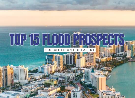
🌊 Miami, Florida
High tidal flooding and storm surge exposure, plus dense coastal development.
- Key stat: ~46% of properties have flood risk today; ~54% projected in 30 years.
- Why it ranks high: Sea-level rise, king tides, tropical cyclone surge, aging drainage.
- Who feels it most: Low-lying bayside and barrier-island neighborhoods.
- Mitigation watch: Elevation projects, pumps, and sea-level adaptation programs.
🌧️ New Orleans, Louisiana
Below-sea-level terrain, levee dependence, and strong surge exposure.
- Key stat: Neighborhoods like South New Orleans show ~99.5% of properties at risk.
- Why it ranks high: Levee overtopping risk during major storms and subsidence.
- Who feels it most: Low-elevation basins encircled by levees and floodwalls.
- Mitigation watch: Surge barriers, pump redundancy, coastal wetland restoration.
⛈️ Houston, Texas (Harris County)
Extreme rainfall and bayou overflow meet rapid urbanization and flat terrain.
- Key stat: FEMA’s index ranks Harris County at the top for hurricane risk; ~322k homes region-wide face flood risk.
- Why it ranks high: Slow-moving storms, dense impervious cover, bayou and reservoir dynamics.
- Who feels it most: Repetitive-loss areas along bayous and low basins.
- Mitigation watch: Channel upgrades, detention, buyouts, smarter land use.
🌫️ Jacksonville, Florida
Confluence of riverine, coastal, and rainfall flooding across a large metro.
- Key stat: Downtown shows ~59% of properties at risk today and ~67% in 30 years.
- Why it ranks high: St. Johns River surge + nor’easters + heavy rain.
- Who feels it most: River-adjacent tracts and beach communities.
- Mitigation watch: Elevation, backflow prevention, green-infra retrofits.
🌁 New York City, New York
Storm surge, intense rain, and dense underground infrastructure elevate risk.
- Key stat: Over 1 in 10 properties in the tri-state are at serious flood risk; NYC faces added inland flood risk from impervious cover and sewer limits.
- Why it ranks high: Nor’easters, tropical remnants, cloudbursts, sea-level rise.
- Who feels it most: Coastal zones, basement apartments, transit-heavy corridors.
- Mitigation watch: Cloudburst plans, coastal defenses, zoning for resilience.
🌧 Philadelphia, Pennsylvania
Heavy rain + aging storm sewer infrastructure = frequent flash and urban flooding.
- Key stat: Multiple neighborhoods face repeated basement and street-level flooding.
- Why it ranks high: Intense rainfall and outdated drainage in dense urban core.
- Who feels it most: Lower-elevation neighborhoods near the Schuylkill and Delaware River.
- Mitigation watch: Green infrastructure, rain gardens, and updated stormwater systems.
⛈️ Charlotte, North Carolina
Storm-supercell systems and intense rainfall over rolling terrain produce widespread flash floods.
- Key stat: Rapid runoff leads to frequent localized flooding in residential areas.
- Why it ranks high: Sudden storms and hills funnel water quickly into neighborhoods.
- Who feels it most: Suburban and hillside communities with limited stormwater capacity.
- Mitigation watch: Detention basins, stormwater upgrades, zoning reform.
🏞 Sacramento, California
Historically low-sloped river basin with seasonal heavy rain; levee and subsidence threats persist.
- Key stat: SRA modeling shows deep flood plain in case of levee failure.
- Why it ranks high: Sacramento and American River levee system is aging; winter rains can overwhelm banks.
- Who feels it most: Low-lying floodplain neighborhoods and agricultural edges.
- Mitigation watch: Levee reinforcements, bypass channels, retrofit programs.
🌆 Chicago, Illinois
Torrential downpours meet old combined sewer systems, leading to basement and street flooding.
- Key stat: Main and basement flooding is frequent during summer cloudbursts.
- Why it ranks high: Overloaded sewers, urban density, and limited pervious surfaces.
- Who feels it most: Central districts and older residential zones.
- Mitigation watch: Sewer separation projects, retention zones, flood-proofing basements.
🌪 St. Louis, Missouri
Spring storms and river overflows combine in a city with limited green infrastructure reach.
- Key stat: Missouri and Mississippi rivers contribute to periodic heavy flood events.
- Why it ranks high: Downstream basin convergence, steep terrain runoff, and saturated soils.
- Who feels it most: Riverfront zones and low-lying neighborhoods in floodplain.
- Mitigation watch: Levee upgrades, upstream retention, floodplain restoration.
🌉 San Francisco Bay Area, California
Sea-level rise and king tides threaten major infrastructure and dense waterfront districts.
- Key stat: Thousands of Bay Area properties sit within projected sea-level rise zones by 2050.
- Why it ranks high: Coastal surge + high-value assets along the bay shoreline.
- Who feels it most: Low-lying areas in Oakland, San Mateo, and San Jose periphery.
- Mitigation watch: Seawall retrofits, wetland restoration, bay adaptation projects.
🌪 Dallas–Fort Worth, Texas
Flash floods from sudden heavy rainfall overwhelm creeks and urban drainage.
- Key stat: Multiple 100-year floods have hit in just the past decade.
- Why it ranks high: Impervious sprawl + climate-driven downpours.
- Who feels it most: Suburban fringe areas with creek crossings and low bridges.
- Mitigation watch: Detention ponds, stricter zoning, stormwater retrofits.
🌴 Tampa, Florida
Hurricane surge and seasonal heavy rains converge in low-lying Gulf Coast communities.
- Key stat: FEMA and local maps show large swaths at storm-surge risk.
- Why it ranks high: Gulf hurricanes, sea-level rise, and inadequate drainage.
- Who feels it most: Coastal neighborhoods around Tampa Bay.
- Mitigation watch: Surge barriers, drainage upgrades, resilient building codes.
🏙 Washington, D.C.
Intense storms and tidal Potomac flooding put government and residential zones at risk.
- Key stat: FEMA maps show Federal Triangle and Mall area in flood zones.
- Why it ranks high: Flash flooding + tidal surge combination.
- Who feels it most: Low-lying government complexes and historic neighborhoods.
- Mitigation watch: Flood walls, pumping stations, and sewer upgrades.
🌀 Charleston, South Carolina
Historic downtown is increasingly hit by king tides and hurricane surge.
- Key stat: Sunny-day tidal flooding has doubled over the last two decades.
- Why it ranks high: Sea-level rise, tidal flooding, hurricane surge.
- Who feels it most: Low-elevation historic core and surrounding barrier islands.
- Mitigation watch: Coastal defense seawalls, drainage tunnel projects, wetland buffers.
Flood risk in the United States is not evenly shared. It is concentrated in coastal hubs, river basins, and growing inland metros where infrastructure was never designed for today’s rainfall and sea-level realities. The fifteen cities listed here illustrate the range of threats communities will face between 2025 and 2026, from storm surge to inland flash floods. Preparing for these challenges requires investment in stronger defenses, smarter land use, and resilient building practices. By recognizing the areas most exposed, we can better direct resources, protect lives, and safeguard the homes and businesses that sit in harm’s way.