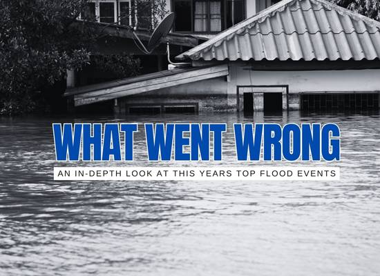
From Texas Hill Country to the Gulf Coast, 2025 proved (again) that floods aren’t rare “acts of God” so much as predictable collisions between hydrology, weather patterns, and human choices. Below, we start our Top 10 with two of the year’s biggest U.S. flood events—what happened, and the specific failure points that turned heavy rain into disaster.
#1 Texas Hill Country (Guadalupe River) — July 4, 2025
Event Snapshot
- Location: Kerr County & downstream along the Guadalupe River.
- Timing: Overnight into the early morning of July 4.
- Hydrology: Guadalupe River at Hunt set an all-time record crest (~37.5 ft).
- Impacts: Catastrophic flash flooding with a death toll reported at 130+ across Central Texas; FEMA major disaster declared (DR-4879-TX).
- Notable: Severe impacts at Camp Mystic with multiple fatalities among campers and staff.
Context: The Hill Country’s “flash-flood alley” topography + thin soils funnel rain rapidly into rivers and creeks, amplifying rise rates.
What Went Wrong (Root Causes)
- Nighttime flash rise: Extreme, rapid river response while many were asleep limited situational awareness and reaction time.
- Warning gaps: NWS watches and warnings were issued, but reliance on cell alerts (spotty reception, phones silenced/off) meant many didn’t get timely, actionable notice; independent siren/river-alarm systems were not widely in place.
- Exposure in floodplains: Riversides and low-lying camp structures remained vulnerable; some buildings had been mapped out of flood zones in prior appeals, underestimating risk.
- Compound vulnerability: Holiday camping density + limited evacuation protocols for overnight events magnified consequences.
What’s Changing
Proposed Texas legislation would require stronger camp emergency plans, on-site alerting systems, and clearer evacuation protocols; federal disaster assistance is active under DR-4879-TX.
#2 Central Gulf Coast (Mobile–Pensacola) — April 6, 2025
Event Snapshot
- Location: Coastal AL & NW FL (Mobile–Baldwin–Escambia counties).
- Rainfall: Broad 3–6″, swath of 6–12″ with 10–12″ near Spanish Fort; Mobile Regional set a daily rainfall record (6.51″).
- Rivers: Rapid rises on the Perdido (FL), Styx (AL), and Fish (AL) Rivers; numerous high-water rescues and impassable roads.
Context: A slow-moving frontal boundary with a deep Gulf moisture plume produced training downpours over the same communities for hours.
What Went Wrong (Root Causes)
- Slow mover + training: The front “crept” east while thunderstorms repeatedly tracked over the same zone, overwhelming drainage.
- Urban runoff: High impervious cover around corridors (Mobile–Eastern Shore) accelerated flash flooding on roads.
- Small river flashiness: Short, responsive basins (Perdido/Styx/Fish) spiked quickly after the heaviest cores.
- Exposure decisions: Numerous vehicles stalled in flooded streets—classic “turn around, don’t drown” breakdown during commutes and errands.
What’s Changing
Post-event reviews emphasize drainage maintenance, roadway closure protocols, and targeted public messaging when “training” setups are forecast.
#3 California Atmospheric Rivers — Feb 1–6 & Feb 12–14, 2025
Event Snapshot
- Two multi-day atmospheric rivers hit Northern CA first, then Southern CA.
- Reports of riverine flooding and landslides in NorCal (e.g., Pit River near Canby over major flood stage).
- SoCal saw evacuation orders, debris flows on recent burn scars, PCH closures, and 5"+ in parts of L.A. County; ~3" at downtown L.A./Beverly Hills in one round.
- At least two storm-related deaths were reported in Northern CA during the early-February round.
Context: Long-duration ARs with high freezing levels focused heavy rain on lowlands/foothills, elevating flood and debris-flow risk, especially over burn scars.
What Went Wrong (Root Causes)
- Burn-scar vulnerability: Recent wildfires stripped vegetation, priming slopes for fast debris flows when intense bands arrived.
- High freezing levels: More precipitation fell as rain (not snow) at mid-elevations, boosting direct runoff to rivers/creeks.
- Urban exposure: Dense hillside development + saturated soils led to mudslides and road closures (e.g., PCH, Mulholland areas).
- Travel/commute timing: Peak bands overlapped with rush hours, increasing vehicle exposures on flooded/landslide-prone roads.
What’s Changing
State and local agencies pre-deployed assets, expanded burn-scar monitoring and debris-flow warnings, and reviewed evacuation/road-closure protocols for future ARs.
#4 Grand Island, Nebraska — June 25–26, 2025
Event Snapshot
- Training thunderstorms parked over central Nebraska overnight.
- NWS Hastings issued a Flash Flood Emergency for Grand Island at ~11:45 p.m. June 25.
- Grand Island airport logged 6.41" on June 25 (new daily and June-any-day record); two-day total ~7.5".
- City declared a state of emergency; widespread road closures, stalled vehicles, sewer backups, and flooded homes.
Context: Convective “training” repeatedly reloaded storms along a boundary, dropping a month’s worth of rain in hours on a flat, urbanized basin.
What Went Wrong (Root Causes)
- Overnight timing: The most intense rain fell late night, catching many drivers and businesses unprepared.
- Storm “training”: Back-building cells focused over the city, overwhelming storm drains and low crossings.
- Urban runoff: Impervious surfaces accelerated street flooding; numerous vehicles were stranded in high water.
- Limited situational awareness: Despite alerts, some travelers entered inundated roads during the emergency window.
What’s Changing
Post-event actions included targeted drainage clean-up, damage assessments, and reinforced messaging on “Turn Around, Don’t Drown” during Flash Flood Emergencies.
#5 Tornado & Flood Outbreak — April 2–7, 2025
Event Snapshot
- Duration: April 2–7 across the South & Midwest.
- Rainfall: Up to 15″ in parts of Kentucky (e.g., Benton, Hickory). Rivers and tributaries crested near record levels.
- Casualties: 24 deaths (15 flood-related, 8 tornadic + 1 indirect).
- Damage: ~$4.8 billion; massive outages and floods across multiple states.:contentReference[oaicite:1]{index=1}
Context: A stalled frontal system and persistent stationary front triggered days of heavy rain, compounding with severe tornado strikes.
What Went Wrong (Root Causes)
- Slow-moving synoptic boundary: Same areas were hammered repeatedly by heavy bands, pushing inland waters over capacity.
- Compound hazards: The system didn’t just flood—it also spawned over 150 tornadoes, stretching emergency response thin.
- Historical cresting: Rivers like Kentucky peaked near or above record flood stages, overwhelming levees and riparian infrastructure.
- Infrastructure strain: Power outages and overwhelmed drainage systems aggravated both urban and rural flooding impacts.
What’s Changing
Emergency services have accelerated upgrades to storm-ready grid infrastructure and flood-aware siren systems, and are expanding multi-hazard resilience planning.
#6 Beitel Creek, San Antonio — June 12, 2025
Event Snapshot
- Location: Beitel Creek, near Loop 410 in San Antonio.
- Rainfall: Over 7″ in three hours—100-year rainfall event, highest daily total in over a decade.:contentReference[oaicite:2]{index=2}
- Fatalities: At least 13 people killed, 15 cars swept off Loop 410.:contentReference[oaicite:3]{index=3}
Context: Urban drainage systems along Beitel Creek were overwhelmed as flash flooding surged without warning late overnight.
What Went Wrong (Root Causes)
- Under-designed drainage: The system couldn’t handle a once-in-a-century deluge rapidly inundating Beitel Creek drainage.
- Floodplain development: Loop 410 and surrounding roads were built within a mapped flood zone, leaving them highly exposed.
- No alert systems: Vehicles on the roadway lacked real-time flood warnings or barriers, leading to tragic rescues and entrapments.
- Timing + darkness: Heavy rainfall began around 2 a.m.—few drivers were alert, and visibility was poor when the flooding struck.
What’s Changing
Local authorities are planning enhanced roadway sensors, automated warning signs, and revisiting land-use policies around Beitel Creek.
#7 Mid-Atlantic (VA–MD–PA, Potomac Basin) — May 13–16, 2025
Event Snapshot
- A slow-moving system brought 2–5"+ rain from western NC into VA and MD, pushing Potomac tributaries rapidly higher.
- Flash Flood Emergencies struck portions of Allegany Co., MD (Georges Creek jumped from ~4 ft to major flood level ~12 ft in hours).
- Schools were evacuated in Westernport, MD; regionwide water rescues and road closures followed.
Context: Training rain bands along a stalled boundary plus upslope/onshore flow focused runoff into small, flashy basins feeding the Potomac.
What Went Wrong (Root Causes)
- Stalled boundary + training: Repeated cells over the same ridge-to-valley corridors overwhelmed headwater creeks.
- Small-basin “flashiness”: Narrow, steep watersheds like Georges Creek respond in minutes, leaving little time for closures/evacuations.
- Exposure during school/commute windows: Rising water intersected bus routes and main streets before broader closures could cascade.
What’s Changing
NWS/MARFC post-event reviews highlight faster school-closure triggers for Flash Flood Emergencies and targeted messaging on headwater rise rates.
#8 New Orleans (Tropical Disturbance Rains) — July 17–21, 2025
Event Snapshot
- A Gulf disturbance (Invest 93L) funneled deep tropical moisture into SE Louisiana.
- City issued sandbag ops; Flood Watch called for 3–6" with local 10" pockets; numerous flash-flood warnings followed.
- By late July, the NWS had logged 40+ flash-flood warnings year-to-date in the metro—among the most active years since the late 1980s.
Context: A slow, moisture-rich wave with weak steering flows produced prolonged downpours, stressing city drainage during peak tides.
What Went Wrong (Root Causes)
- Slow mover + training bands: Repeated tropical downpours exceeded pump and roadway capacity in short bursts.
- Tide timing: Elevated water levels reduced outflow efficiency from surface drains during heaviest rain windows.
- High baseline wetness: A wetter-than-normal year primed neighborhoods for rapid street flooding when intense cells parked.
What’s Changing
City alerts emphasized sandbagging and low-lot parking; forecasters flagged a rare pace of 2025 warnings—fueling renewed focus on pump ops and public readiness.
#9 Northeast & Mid-Atlantic — July 27–29, 2025
Event Snapshot
- Regions affected: New Jersey, New York, eastern Pennsylvania, and southern New England.
- Rainfall: 5–9" totals common; isolated 10"+ in parts of NJ (Morris/Passaic counties).
- Impact: Dozens of water rescues, widespread basement flooding, and major delays on NJ Transit and Amtrak corridors.
- Fatalities: At least 6 people drowned in vehicles and low-lying homes.
Context: A tropical moisture plume from the Atlantic linked with a cold front, setting up training thunderstorms over the I-95 corridor.
What Went Wrong (Root Causes)
- Urban imperviousness: Dense Northeast cities saw rapid runoff overwhelming drainage within minutes.
- Late-evening surges: Peak rainfall bands came during evening commutes, trapping drivers on highways.
- River-lag plus flash: Quick creek rises compounded by slower river responses extended flooding into following days.
- Preparedness gap: Many residents underestimated flash-flood risk versus hurricanes, leading to stalled cars and flooded basements without pumps.
What’s Changing
Regional planners are reassessing stormwater standards and updating flash-flood risk communication, especially for rail/bus commuters.
#10 Phoenix Metro (AZ Monsoon) — August 23–24, 2025
Event Snapshot
- Monsoon burst drenched Phoenix, Mesa, and Scottsdale with 3–5" in 24 hours.
- Sky Harbor Airport reported its wettest August day on record (3.88").
- Impacts: Major freeway closures (I-10, Loop 202), hundreds of vehicle water rescues, power outages, and flooded neighborhoods.
- Fatalities: At least 4 deaths confirmed, primarily from vehicles swept in washes.
Context: Deep tropical moisture surged north from the Gulf of California, colliding with desert heat to trigger historic rainfall bursts.
What Went Wrong (Root Causes)
- Urban floodplain: Phoenix’s rapid growth pushed homes and roads into low desert washes highly vulnerable to flash flooding.
- Drainage limits: Desert soils shed water quickly; combined with undersized urban drainage, flooding was inevitable.
- Driver exposure: Dozens ignored barricades and attempted low-water crossings, overwhelming first responders.
- Infrastructure stress: Highways lacked enough flood-control culverts to handle such rainfall intensity.
What’s Changing
Officials vowed stricter enforcement of “Stupid Motorist” laws, expanded urban drainage projects, and faster closure of flood-prone freeways during monsoon bursts.