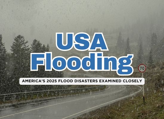
The first months of 2025 have been anything but calm. From the mountain valleys of Kentucky to the storm-drenched plains of South Texas, record-breaking floods have disrupted lives, claimed homes, and left communities in turmoil. These weren’t just isolated weather events—they were the result of a changing climate, aging infrastructure, and gaps in preparation. In this deep dive, we’ll break down the three most devastating floods so far this year, examine what contributed to each disaster, and explore how better planning could help prevent the worst next time.
1️⃣ The Appalachian Torrent – February 15–16, 2025
In mid-February 2025, a slow-moving storm system stalled over the Appalachian region, dumping relentless rain across Kentucky, West Virginia, Tennessee, and Virginia. What began as a forecasted rain event escalated into one of the worst flood disasters in recent memory.
🌧️ The Build-Up:
- Over 7 inches of rain fell within 48 hours across already saturated ground.
- Snowmelt from the surrounding highlands added to the volume, pushing river systems beyond capacity.
- The North Fork of the Kentucky River reached a historic crest, overwhelming levees and floodwalls.
🚨 What Went Wrong:
- Many flood-prone areas lacked updated hazard maps, leaving residents unaware they were at serious risk.
- Emergency communication systems were overloaded or delayed in rural areas, where evacuations often came too late.
- Critical infrastructure, including drainage systems and culverts, had not been upgraded in decades.
🔧 Steps That Could Have Helped:
- Modernized Floodplain Mapping: Accurate maps would have warned at-risk residents earlier and helped guide smarter land use planning.
- Investment in Rural Warning Systems: More robust alert systems, like text-based evacuation notices and sirens in remote valleys, could have saved lives.
- Improved Infrastructure Maintenance: Regular clearing of culverts, investment in stormwater management, and rebuilding vulnerable bridges and roads would have reduced damage.
🧭 The Aftermath:
- At least 14 people lost their lives in Kentucky alone.
- Thousands of homes were damaged or destroyed, many of them uninsured due to being outside of outdated flood zones.
- Local governments called for emergency funds and long-term federal infrastructure aid.
This flood served as a harsh reminder: even in areas that don’t typically make headlines, the combination of extreme weather and under-preparedness can be deadly.
2️⃣ The Drenched Borderlands – March 27, 2025
On March 27, 2025, South Texas found itself at the mercy of a freak weather event. In just a matter of hours, the skies unleashed torrents of rain—over 21 inches in some towns—turning quiet neighborhoods and busy highways into raging rivers. Cities like Harlingen and McAllen were hit hardest, with widespread power outages, water rescues, and heartbreaking losses.
🌪️ What Sparked the Deluge:
- A stalled low-pressure system off the Gulf of Mexico pulled in warm, moisture-rich air, creating a conveyor belt of thunderstorms that wouldn’t move.
- The region’s flat terrain and clay-heavy soil couldn’t absorb the water fast enough, leading to rapid surface runoff.
- Drainage systems, already stressed by development and population growth, failed to keep up.
🚨 Where It Broke Down:
- Many neighborhoods were built without adequate flood planning, with older developments lacking retention ponds or proper elevation.
- Emergency crews were overwhelmed—rescue boats couldn’t reach all trapped residents in time.
- Communication gaps left many unaware of just how severe the storm would be. Flash flood warnings were issued, but some areas had only minutes to act.
💡 What Could Have Made a Difference:
- Urban Planning with Flooding in Mind: South Texas cities need stricter development rules in flood-prone zones, including elevation standards and water retention systems.
- Investment in Green Infrastructure: Swales, wetlands, and permeable pavement could have helped soak up rainfall naturally, easing the burden on sewers.
- Community-Based Preparedness Drills: With growing urban sprawl, local response plans need to be practiced and understood—especially in underserved neighborhoods where resources are thinner.
🌊 The Aftermath:
- At least 4 confirmed fatalities, dozens injured, and hundreds rescued by boat.
- Thousands of homes and businesses flooded, with initial damage estimates climbing into the hundreds of millions.
- A state of emergency was declared, and disaster declarations followed, but recovery will be slow—especially for low-income families without flood insurance.
This wasn’t just a storm. It was a warning siren for every city across the Gulf Coast: climate volatility is here, and our systems are still playing catch-up.
3️⃣ The Cross-Country Cascade – Late March , Early April
At the end of March 2025, a powerful spring system swept across the central United States, bringing a destructive mix of tornadoes, severe thunderstorms, and flash floods. What made this storm different wasn’t just the speed or strength, it was the sheer size. The system moved like a bulldozer, stretching from Texas all the way into New York and the Carolinas. Five people lost their lives. Millions were affected.
⛈️ How It Unfolded:
- A deepening low-pressure system collided with warm, moist air from the Gulf and frigid air from the Rockies—an ideal recipe for violent storms.
- Supercells generated severe hail and tornadoes across Oklahoma, Missouri, and Arkansas.
- As the storm pushed east, it dropped inches of rain in hours across saturated ground in the Southeast and Mid-Atlantic.
⚠️ Why the Flooding Was So Widespread:
- The storm covered a huge area, hitting places that had already received above-average rainfall earlier in March.
- Many rivers were already running high, and drainage systems—especially in older cities like Baltimore and Richmond—were overwhelmed quickly.
- In urban areas, paved surfaces meant little absorption, turning streets into flood channels within minutes.
🔍 What Could Have Been Done Better:
- Proactive Reservoir Management: In some areas, dams and levees weren’t preemptively relieved, which could have created more room for runoff.
- Urban Retrofits: Cities still reliant on 20th-century stormwater systems should be modernizing with dual-drainage approaches—handling both normal flow and extreme surges.
- Regional Forecast Coordination: Some regions saw conflicting forecasts. More unified communication between federal and local weather services could improve clarity in fast-moving events.
💥 The Fallout:
- Flash flooding trapped drivers in underpasses and washed out major roads, including parts of I-95.
- Airports in Atlanta, Charlotte, and D.C. saw massive delays and cancellations due to both wind and flooding.
- Power outages affected over 600,000 customers across five states, many for multiple days.
4️⃣ The San Antonio Tempest – June 12, 2025
🌧️ The Event:
On June 12, an overnight thunderstorm dumped over 6 inches of rain across San Antonio in just a few hours, making it one of the ten rainiest single days in over a century.
🚨 The Breakdown:
- Residential streets, underpasses, and the major Loop 410 corridor, especially near Beitel Creek and Perrin Beitel Road, turned into dangerous waterways.
- Dozens of vehicles were swept away; first responders conducted high-water rescues around the clock.
🕯️ Human Toll:
- 13 fatalities have been confirmed, with several others injured or initially reported missing.
- The city experienced some of its deadliest flash flooding in recent memory.
🔧 What Could Have Helped:
- Targeted warning systems in flood-prone corridors like Loop 410/Beitel Creek—like sirens or CodeRED alerts—might have prevented many from entering the flood zone.
- Infrastructure improvements, such as enhancing low-lying underpasses with pumps or emergency gates, could reduce roadway inundation.
- Improved forecast-to-action protocols, including faster high-water alerts and real-time closure updates, are vital.
🧭 Aftermath:
- San Antonio officials initiated joint disaster declarations and investigations, including engineering reviews of flood control structures and drainage systems.
- Emergency services are now working to develop automated notifications and proactive evacuations in vulnerable areas.
5️⃣ The Central Texas Catastrophe – July 4–7, 2025
🌊 The Event:
Remnants of Tropical Storm Barry stalled over Central Texas, triggering “training” thunderstorms that dumped up to 20 inches of rain in parts of the Hill Country—especially across Kerr and surrounding counties. The Guadalupe River surged by 26–34 feet in under an hour, overwhelming riverbanks, homes, campgrounds, and bridges.
🕯️ Human Toll:
- At least 132 confirmed fatalities, including over 106 in Kerr County alone, with approximately 160 people still missing.
- Among the victims were 27 campers and counselors at Camp Mystic.
🚨 What Went Wrong:
- Failure to issue broad IPAWS alerts: Kerr County delayed sending emergency notifications until after the flood hit, relying on opt‑in systems like CodeRED.
- Lack of real‑time sirens and flood gauges: Despite repeated warnings, high‑risk zones had no direct alert triggers for residents or campers.
- Rapid onset and poor terrain response: Steep, rocky terrain channeled water aggressively—classic “Flash‑Flood Alley” topography.
🔧 What Could Have Helped:
- Instant IPAWS or NOAA Weather Radio alerts, automatically triggered by upstream river sensors or forecast thresholds.
- Flood‑aware land‑use policy: Camp Mystic and other developments sat directly in floodways—updating zoning could prevent such placement.
- Stream gauges with automated warnings, linked to mobile alerts for high‑risk zones.
- Evacuation drills in youth camps during monsoon season, with evacuation routes planned well in advance.
🧭 The Aftermath:
This event now ranks as one of Texas’s deadliest natural disasters, surpassing several major hurricanes.
Federal and state disaster declarations are active for six counties; volunteer search-and-rescue efforts continue amid recurring storms.
Investigations are underway into warning systems, floodplain regulations, and emergency protocols—and funding proposals for flood gauges and siren networks are being debated .
This storm underscored a truth that’s becoming harder to ignore: floods don’t need a named hurricane to devastate. When the ground is soaked and the clouds won’t move, floodwaters rise fast, sometimes faster than our cities and systems can handle.
The floods of 2025 weren’t isolated events. They were clear signs of a larger shift already underway. As climate patterns change and extreme rainfall becomes more common, yesterday’s strategies are no longer enough. Places that used to flood once in a generation are now seeing water in their streets every few years. And for many communities, the next flood is already on its way.
But this isn’t only a story of destruction. It’s a chance to do better. We already have the knowledge to design safer cities, build stronger warning systems, and focus resources where they’re needed most. From green infrastructure and accurate flood maps to smarter development and public readiness, every step matters.
Floodwaters don’t respect boundaries. But how we plan, invest, and prepare will determine whether we continue to chase disasters or start getting ahead of them.