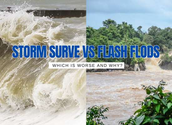
When water rises fast, labels matter. Storm surge and flash flooding both turn streets into rivers, yet they form differently and demand different decisions. Understanding what drives each one, where it strikes, and how to respond can be the difference between a close call and a catastrophe.
A rapid rise of ocean water pushed onshore by strong winds and low pressure. Often the deadliest part of a landfalling storm.
What it is
Abnormal sea level rise on top of the tide. Wind piles water toward shore, and low pressure lets the ocean dome upward. Bays, estuaries, and inlets can funnel water higher than nearby open coastlines.
Risk snapshot
- Depth: Can exceed 10 to 20 feet in major hurricanes.
- Extent: Water can push several miles inland in low areas.
- Timing: Peaks near landfall, often around high tide.
- Forces: Strong waves, debris, and fast currents cause structural failure.
- Aftermath: Saltwater damage, erosion, contamination, downed power.
Where it hits
Ocean and Gulf coasts, barrier islands, bays, river mouths, tidal rivers, and back bays. Water can travel inland along canals and low coastal roads.
Primary drivers
- Storm intensity and wind field size
- Angle of approach and forward speed
- Local bathymetry and shoreline shape
- Tide stage at landfall
Early signals
- Waterline creeping higher hours before landfall
- Unusually strong onshore winds and long-period swell
- Low-lying roads or docks flooding first
Top mistakes to avoid
- Waiting to see water at your door before leaving
- Driving through saltwater on coastal roads
- Relying on sandbags for deep surge
- Staying in single-story coastal buildings
Protective moves
- Know your surge zone and evacuation route
- Leave early when orders are issued
- Move vehicles and valuables to higher ground
- Shut off power at the main if told and safe to do so
- Elevate appliances and critical electronics
Quick checklist
- Photo ID, meds, chargers, cash, documents
- Go-bag with water and shelf-stable food
- Fuel your car and plan two exit routes
- Tell a contact where you are going
Always follow local emergency management and National Weather Service guidance.
Rapid flooding of low-lying areas, streets, or streams triggered by heavy rain, dam failures, or blocked drainage. Can strike within minutes and with little warning.
What it is
A sudden surge of water overwhelming streets, creeks, and drains. Unlike river floods, flash floods form quickly and often fade within hours, but with devastating force.
Risk snapshot
- Depth: Can range from ankle-deep to several feet.
- Speed: Water moves with extreme force in narrow channels.
- Timing: Can occur within minutes of heavy rain.
- Hazards: Sweeps away cars, undermines roads, topples trees.
- Aftermath: Debris fields, mudslides, and road closures.
Where it hits
Low-lying streets, urban areas with poor drainage, valleys, canyons, underpasses, and near small rivers or creeks. Even parking lots can turn into dangerous channels.
Primary drivers
- Intense thunderstorms or stalled rain bands
- Hurricanes and tropical storms moving inland
- Dam or levee failures
- Drainage system overload or blockage
Early signals
- Rainfall rates exceeding 1–2 inches per hour
- Water rising quickly in roadside ditches
- Storm drains bubbling or backing up
- National Weather Service flash flood warnings
Top mistakes to avoid
- Driving into flooded intersections (“Turn Around, Don’t Drown”)
- Camping near streams during storm season
- Underestimating water depth in underpasses
- Assuming daylight visibility means safety
Protective moves
- Monitor forecasts and flood-prone zones
- Move to higher ground at the first sign
- Avoid bridges or fast-moving streams
- Keep an emergency go-bag in your vehicle
Quick checklist
- Flashlight and extra batteries
- Portable weather radio
- First aid kit and medications
- Maps with alternate routes marked
Always heed official warnings — water depth and current strength are often greater than they appear.
| 🌊 Storm Surge | ⛈️ Flash Flood | |
|---|---|---|
| Cause | Ocean water pushed inland by storm winds & pressure drop | Heavy rainfall overwhelming terrain or drainage, sudden dam/levee failure |
| Where it strikes | Coastal zones, bays, tidal rivers, barrier islands | Urban streets, valleys, creeks, underpasses |
| Onset speed | Hours as storm nears | Minutes to hours after rainfall |
| Typical depth | 10–20+ feet with waves & currents | Inches to several feet, fast & debris-filled |
| Duration | Peaks at landfall, lasts hours | Short-lived but violent (hours) |
| Key hazards | Structural collapse, erosion, salt damage, long outages | Road washouts, swept vehicles, mudslides, hidden currents |
| Warning signals | Coastal flood watches, rising tides hours ahead | Flash flood warnings, drains backing up, ditches rising fast |
| Best response | Evacuate surge zones early, move valuables & cars to high ground | Immediately seek higher ground, avoid driving or low crossings |
So which is worse, storm surge or flash floods? The truth is, both kill more people than the winds of a hurricane ever do. Storm surge is the bigger coastal threat, capable of wiping entire neighborhoods off the map in a single night. Flash floods are the inland danger, sudden and often invisible until water is already at your door.
The real answer depends on where you live. Near the coast, storm surge is the force that can change the landscape for decades. Inland, flash flooding is the silent killer that turns streets into rivers in minutes. One is slower to build but overwhelming in scale, the other is fast, unpredictable, and unforgiving.
Neither should ever be underestimated. Know your zone, heed the warnings, and move early. Water doesn’t give second chances.


