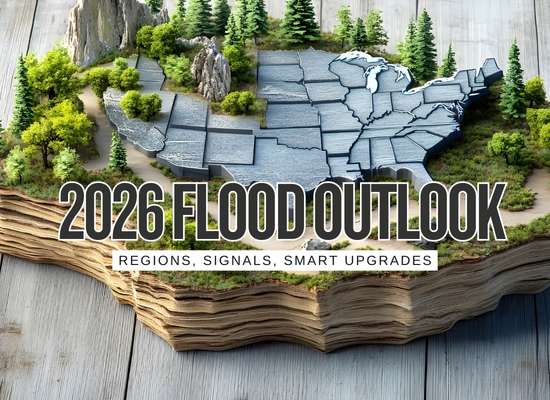
Flood season is not one season anymore. In 2026, the smartest “outlook” is a simple watchlist: the signals to monitor, the months they usually matter, and the upgrades that actually reduce damage when a forecast is wrong.
This is not a single-map prediction. It is a practical watchlist: which signals matter, when they usually matter, and the upgrades that reduce damage even when a forecast misses.
Most expensive floods are not caused by an annual average. They are caused by a short chain: (1) saturated ground or fast snowmelt, (2) one or two heavy rain events, (3) a drainage bottleneck. Your best 2026 plan is to reduce step (3), and monitor step (1) so you get more warning time.
Pick what you care about. Each lane includes signals + actions that actually lower damage.
Forecast discussions highlight higher uncertainty for precipitation because patterns may shift within the month. That is exactly when people get surprised: one storm does the damage even if the month ends up “near normal.”
The January precipitation outlook favored wetter conditions from the Northwest and Northern Rockies toward the Southwest coast, with a drier tilt over parts of western Texas and the Southeast.
Week 3 to 4 outlooks indicated higher chances of drier-than-median precipitation in the Southwest and Southeast, while wetter conditions were favored in interior Northwest areas, the Rockies, the Great Lakes, and northern New England.
River flooding risk builds when water is stored (snowpack, soil moisture, reservoirs) and then released fast (warm rain, rapid melt, ice jams). In 2026, track the storage more than the headlines.
NOAA’s operational significant river flood outlook is designed for broader “moderate and above” river flooding, not every minor flood and not localized flash flooding.
Best use: if you live along a river, it can help you spot weeks when the background risk is elevated, so you can pre-stage.
| Move | When it pays off most |
|---|---|
| Know your “first-in” roads | Before spring. Plan alternate routes for school, work, and deliveries. River floods often cut the same low spots first. |
| Pre-stage a water barrier kit | When a warning becomes a watch. Having it ready beats a last-minute store run where inventory is gone. |
| Move vehicles early | Overnight crest scenarios. Vehicle losses happen because people wait for visual water, then roads become impassable. |
A lot of 2026 flood damage will still be: one intense rain, storm drains overwhelmed, water taking the easiest path into basements, garages, and low doors. You cannot control rainfall rate, but you can widen the exit routes.
The theme: water will find the weak link. Your job is to remove the easy paths into the structure.
The coastal reality is not only hurricanes. It is also high tide flooding that stacks with rainfall, waves, and drainage limits. That stacking is where “minor” becomes expensive.
NOAA’s annual outlook summarizes expected high tide flood days by region for the 2025-2026 meteorological year. Even if you are inland, this matters when coastal surge and tides slow river discharge and overwhelm stormwater outfalls.
| Region (NOAA) | Predicted high tide flood days (range examples) |
|---|---|
| Northeast | Region predicted 6 to 12 days; some stations higher (example: Boston predicted 12 to 19). |
| Mid-Atlantic | Region predicted 8 to 13 days; some stations higher (example: Windmill Point, VA predicted 13 to 21). |
| Southeast | Region predicted 6 to 9 days; some stations higher (example: Trident Pier, FL predicted 16 to 22). |
| West Gulf Coast | Region predicted 6 to 15 days; some Galveston Bay stations much higher (example: Eagle Point, TX predicted 38 to 60). |
| Pacific Islands | Predicted 8 to 20 days (highest regional range in the outlook). |
This outlook counts exceedances of local thresholds and notes that compound flooding (waves, weather events, river discharge) can add to routine impacts.
You can buy sandbags in an afternoon. You cannot buy time. In 2026, timing issues (effective dates, policy limits, program authorization) are a real risk layer, especially when a storm is on the horizon.
NFIP flood insurance coverage typically takes effect 30 days after purchase, with specific exceptions (such as certain mortgage-related situations).
If you are moving, refinancing, or changing coverage, ask directly how timing applies to your exact situation.
Flood insurance has basement limitations. In NFIP rules, many personal property items stored in a basement are not covered, with coverage limited to specific listed items.
Practical move: keep valuables and electronics out of the basement unless you are comfortable self-insuring them.
NFIP maximum limits commonly referenced are up to $250,000 for residential building coverage and up to $100,000 for residential contents (limits differ for non-residential).
If rebuild costs exceed limits, your “gap plan” matters (savings, additional coverage options, mitigation to reduce losses).
This is a simple self-check. It does not predict floods. It predicts how hard a flood will hit you if it arrives.
Best for the big ocean pattern that nudges U.S. seasonal odds.
Shows the reasoning behind precipitation and temperature tilts.
Useful for mid-month pattern shifts.
Coastal baseline flooding, plus regional context.
Timing rules and exceptions in plain language.
This is a practical outlook, not a promise. It breaks the country into major regions and gives you: signals to monitor, the flood types that usually cause expensive damage, and the upgrades that reduce loss.
Use this to get “what to do first” guidance, then open the full regional section below.
These do not forecast your street, but they can tilt odds for storm tracks, snowmelt timing, and coastal nuisance flooding.
| Signal | How to use it for flood planning |
|---|---|
| ENSO (La Niña to neutral) | Good for broad seasonal odds and storm-track tendencies. Use it as a planning input, not a guarantee. |
| Monthly and Week 3-4 precipitation outlooks | Best for “soil loading” risk. A wetter tilt means more saturated ground and less capacity for the next big rain. |
| River outlooks | Use for moderate-and-above river flooding potential. Pair it with local river forecasts and warnings. |
| High tide flooding outlook | Coastal baseline matters because high tides can stack with rain, winds, and river discharge. |
- CPC outlooks: https://www.cpc.ncep.noaa.gov/
- Weeks 3-4 outlook: https://www.cpc.ncep.noaa.gov/products/predictions/WK34/
- NOAA water services: https://water.noaa.gov/
- High tide flooding outlook: https://tidesandcurrents.noaa.gov/high-tide-flooding/annual-outlook.html
🌲
Pacific Northwest + Northern Rockies
Common flood types: atmospheric rivers, rain-on-snow, landslides, fast rivers.
- Multi-day heavy rain: soil saturation + another system is when rivers jump.
- Warm storms on snow: rain-on-snow can create rapid runoff.
- Burn scars and steep terrain: higher debris-flow and flash flood sensitivity.
- Downspout discharge control: keep roof water away from foundations and slopes.
- Clear culverts and ditches: local drainage failures often cause the first property damage.
- Driveway channel strategy: stop sheet flow into garages and low doors.
🌧️
California (Coast + Inland)
Common flood types: atmospheric rivers, urban flash flooding, burn-scar debris flows.
- Atmospheric river sequences: the second or third storm often does the worst damage because ground is already saturated.
- Short-duration extreme rain: overwhelms storm drains and creates fast street flooding.
- Burn scar alerts: debris flows can happen quickly and violently.
- Keep drains clear: curb inlets, yard drains, driveway channels.
- Garage threshold defense: stop driveway sheet flow at the door line.
- Document and stage: move storage off slabs, stage towels, wet vac, fans plan.
🌵
Southwest Desert (AZ/NM/Southern NV)
Common flood types: flash floods in washes, urban runoff, post-fire flooding.
- Monsoon bursts: short storms can produce dangerous runoff in washes.
- Hard ground after dry spells: water runs off faster than people expect.
- Drainage chokepoints: underpasses, low roads, neighborhoods built around washes.
- Keep desert channels open: do not block flow paths with landscaping changes.
- Door and garage sealing: protect low entry points from fast street runoff.
- Vehicle plan: identify the low crossings to avoid and the higher parking option.
🏔️
Central Rockies
Common flood types: snowmelt floods, rain-on-snow, fast creeks, debris flows.
- Spring temperature swings: rapid warming can accelerate melt and raise creeks.
- Warm rain on snowpack: a high-impact setup for runoff.
- Ice jam risk: can cause sudden, localized flooding along rivers.
- Protect lower levels: water alarms, lifted storage, sump readiness where applicable.
- Drainage channels: keep meltwater away from foundations and drive it to safe outlets.
- Road access plan: know which routes wash out and where to stage supplies.
🌾
Northern Plains
Common flood types: snowmelt, ice jams, spring river flooding, heavy rain on saturated ground.
- Frozen ground + rain: increases runoff dramatically.
- Rapid melt windows: crest risk rises when warming is fast.
- Ice movement: sudden water rises can happen even without new rain.
- Backflow planning: sewer backup prevention where issues are known.
- Basement staging: keep valuables off the floor and have a dry-out plan ready.
- River readiness: vehicles, fuel, and barrier kit staged early when outlooks turn elevated.
⛈️
Southern Plains
Common flood types: intense thunderstorms, urban flash flooding, river rises after training storms.
- Training storms: repeated cells over the same corridor can flood quickly.
- Nighttime events: surprise flooding happens when people sleep and drains clog.
- Creek response: small watersheds can rise fast after short, intense rain.
- Clear curb inlets: neighborhood street flooding often starts at blocked drains.
- Garage edge defense: threshold barriers and door bottoms.
- Alerting: water alarms at low points and near mechanicals.
🏙️
Midwest + Great Lakes
Common flood types: spring rain + saturated soils, basement seepage, river flooding, urban flash floods.
- Soil moisture loading: a wet month makes the next storm more dangerous.
- Ice and melt: drainage systems can be blocked when the first big rains arrive.
- Lake-adjacent storms: wind and lake levels can add impact to coastal areas of the lakes.
- Sump reliability: test schedule, discharge away from foundation, backup plan.
- Downspout routing: avoid recirculating water right back into the foundation zone.
- Backflow awareness: know if your risk is groundwater, stormwater, or sewer backup.
🌊
Northeast
Common flood types: coastal flooding, heavy rain, winter storms, river flooding in valleys.
- Coastal baseline: high tides can create recurring nuisance flooding and compound impacts.
- Nor’easter setups: multi-day wind and rain increases coastal and river stress.
- Snow then rain: rapid melt plus rain increases runoff.
- Coastal days plan: avoid low parking, protect basement vents and low doors.
- Drainage maintenance: curb drains and property outlets clear before winter storms.
- Documenting: photo inventory and quick “move-up” plan for valuables.
🧭
Mid-Atlantic
Common flood types: tidal flooding, heavy rain, river flooding, urban runoff.
- High tide stacking: when high tides coincide with heavy rain, drainage is slower.
- Slow-moving storms: multi-hour rainfall overwhelms stormwater systems.
- Creek corridors: small basins can surge quickly.
- Backflow points: identify and address sewer or drain backflow risk where known.
- Entry-point defense: low doors, window wells, garage edges.
- Community drains: clear local inlets before forecast heavy rain.
🌦️
Southeast (Inland)
Common flood types: intense thunderstorms, tropical moisture surges, flash flooding in low areas.
- Training thunderstorms: repeated cells can flood neighborhoods quickly.
- Tropical moisture plumes: even without a landfalling storm, rainfall can be extreme.
- Rapid creek response: small watersheds rise fast after intense rain.
- Drain and ditch maintenance: keep exits open.
- Door/garage thresholds: reduce indoor entry from sheet flow.
- Alerts and dry-out kit: stop minor water from becoming major damage.
🌀
Gulf Coast
Common flood types: heavy rain, storm surge and tidal flooding, compound flooding near bays and rivers.
- High tides and coastal setup: nuisance flooding can create a higher starting water level.
- Slow tropical systems: rainfall totals can be the main driver of damage.
- Compound risk: heavy rain + high tide slows drainage outfalls.
- Protect low openings: door thresholds, garage edges, vents where appropriate.
- Backflow planning: sewer and stormwater backflow can be a main failure mode.
- Vehicle plan: avoid leaving cars in known low spots on high-tide and heavy-rain days.
❄️
Alaska
Common flood types: ice jams, rain-on-snow, coastal storms, rapid melt events.
- Warm spells: rapid melt can change conditions quickly.
- Coastal winds: storm-driven water levels can affect coastal communities.
- Ice dynamics: localized flooding can happen with ice movement.
- Access plan: supplies staged for road interruptions.
- Protect building edges: drainage away from foundations during melt events.
- Local warnings: rely on local forecasts and river products for actionable calls.
🌺
Hawaii
Common flood types: short intense rain, stream flooding, coastal impacts from swell and tides.
- High-rate rainfall: brief storms can flood quickly in steep terrain.
- Stream response: small watersheds can rise fast.
- Coastal stacking: tides plus swell and rain increase impacts in low coastal areas.
- Drain clearing: keep flow paths open.
- Entry defense: protect low doors and ground-floor storage.
- Route awareness: avoid low crossings during heavy rain watches.
A 2026 flood outlook is most useful when it tells you what to monitor and what to fix, not when it pretends to predict exact flood days. If you track the official signals and keep your “water exits” and power backup plans tight, you reduce losses across almost every flood type.